Sprinzl, Maria
Sprinzl, Maria is an office in Kautzen, Waidhofen an der Thaya District, Lower Austria. Sprinzl, Maria is situated nearby to the church hl. Maria, as well as near the peak Hutbühel.| Tap on a place to explore it |
Places of Interest Nearby
Highlights include hl. Johannes Nepomuk and Dobersberg Airport.
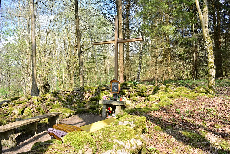
hl. Johannes Nepomuk
Wayside shrine

Photo: Duke of W4, CC BY-SA 3.0 at.
hl. Johannes Nepomuk is a wayside shrine, which is situated 710 metres west of Sprinzl, Maria.
Dobersberg Airport
Aerodrome

Photo: Carsten Steger, CC BY-SA 4.0.
Dobersberg Airport is a private use airport located 2 kilometres west-northwest of Dobersberg, Lower Austria, Austria.
Schloss Illmau
Castle
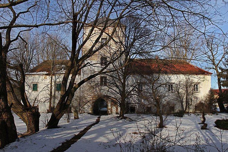
Photo: Duke of W4, CC BY-SA 3.0 at.
Schloss Illmau is a castle, which is situated 2½ km west of Sprinzl, Maria.
Places in the Area
Nearby places include Veclov and Romava.
Veclov
Hamlet

Photo: Fojsinek, CC BY-SA 3.0.
Veclov is a hamlet, which is situated 6 km northwest of Sprinzl, Maria.
Eggern
Village

Photo: Duke of W4, CC BY-SA 3.0.
Eggern is a town in the district of Gmünd in the Austrian state of Lower Austria. Eggern is situated 9 km west of Sprinzl, Maria.
Sprinzl, Maria
- Type: Business
- Address: 5a, Tiefenbach
- Category: office
- Location: Kautzen, Waidhofen an der Thaya District, Lower Austria, Austria, Central Europe, Europe
- View on OpenStreetMap
Latitude
48.92966° or 48° 55′ 47″ northLongitude
15.2677° or 15° 16′ 4″ eastOpen location code
8FWQW7H9+V3OpenStreetMap ID
node 12146217814OpenStreetMap feature
office=company
This page is based on OpenStreetMap, Wikidata, and Wikimedia Commons.
We’d love your help improving our open data sources. Thank you for contributing.
Satellite Map
Discover Sprinzl, Maria from above in high-definition satellite imagery.
Notable Places Nearby
Highlights include hl. Maria and Hutbühel.
Nearby Places
Explore places such as Tiefenbach bei Kautzern Kapelle and Dorfschenke Heidi Wöhri.
Lower Austria: Must-Visit Destinations
Delve into St. Pölten, Wiener Neustadt, Amstetten, and Klosterneuburg.
Curious Places to Discover
Uncover intriguing places from every corner of the globe.
About Mapcarta. Data © OpenStreetMap contributors and available under the Open Database License". Text is available under the CC BY-SA 4.0 license, except for photos, directions, and the map. Photo: Lonezor, CC BY-SA 3.0.