Rue de Lausanne
Rue de Lausanne is a bus stop in Vallorbe, Jura-Nord vaudois District, Vaud. Rue de Lausanne is situated nearby to the museum Musée du fer et du chemin de fer, as well as near the tourism office Office du Tourisme.| Tap on a place to explore it |
Places of Interest Nearby
Highlights include Vallorbe railway station and Le Day railway station.
Vallorbe railway station
Railway station

Photo: G CHP, CC BY-SA 2.5.
Vallorbe railway station is a station at the border of Switzerland and France on the TGV Lyria line between Paris and Lausanne. It is located at the south-eastern entrance of the tunnel which tunnels one of Jura's mountain ranges, Le Mont d’Or. Vallorbe railway station is situated 1 km west of Rue de Lausanne.
Le Day railway station
Railway station
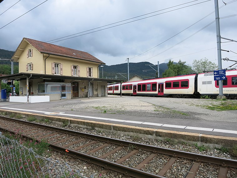
Photo: Paebi, CC BY-SA 4.0.
Le Day railway station is a railway station in the municipality of Vallorbe, in the Swiss canton of Vaud. It sits at the junction of the standard gauge Simplon line of Swiss Federal Railways and Vallorbe–Le Brassus line of SBB and Travys. Le Day railway station is situated 1½ km northeast of Rue de Lausanne.
Le Day Viaduct
Bridge

Photo: Scotlandyard, CC BY-SA 3.0.
The Le Day viaduct is a railway viaduct in Vallorbe in the Jura-Nord vaudois District of the Swiss canton of Vaud. It stands near the hamlet of Le Day and crosses the Orbe. Le Day Viaduct is situated 1½ km northeast of Rue de Lausanne.
Places in the Area
Nearby places include Vallorbe and Vaulion.
Vallorbe
Village

Photo: Rémih, CC BY-SA 4.0.
Vallorbe is a municipality in the district of Jura-Nord Vaudois in the canton of Vaud in Switzerland.
Vaulion
Village

Photo: Ludo29, CC BY-SA 3.0.
Vaulion is a municipality in the district of Jura-Nord Vaudois in the canton of Vaud in Switzerland. Vaulion is situated 2½ km south of Rue de Lausanne.
Ballaigues
Village

Photo: DidiWeidmann, CC BY-SA 3.0.
Ballaigues is a municipality in the district of Jura-Nord Vaudois in the canton of Vaud in Switzerland. Ballaigues is situated 3 km northeast of Rue de Lausanne.
Rue de Lausanne
- Type: Bus stop
- Category: transportation
- Location: Vallorbe, Jura-Nord vaudois District, Vaud, Western Switzerland, Switzerland, Central Europe, Europe
- View on OpenStreetMap
Latitude
46.7115° or 46° 42′ 41″ northLongitude
6.3846° or 6° 23′ 5″ eastOperator
TRAVYS AutoNetwork
MobilisOpen location code
8FR8P96M+JROpenStreetMap ID
node 12148711333OpenStreetMap feature
highway=bus_stopOpenStreetMap feature
public_transport=platform
This page is based on OpenStreetMap, Wikidata, and Wikimedia Commons.
We’d love your help improving our open data sources. Thank you for contributing.
Satellite Map
Discover Rue de Lausanne from above in high-definition satellite imagery.
Notable Places Nearby
Highlights include Musée du fer et du chemin de fer and Office du Tourisme.
Nearby Places
Explore places such as Rue de Lausanne and STEP.
Vaud: Must-Visit Destinations
Delve into Lausanne, Montreux, Nyon, and Vevey.
Curious Bus Stops to Discover
Uncover intriguing bus stops from every corner of the globe.
About Mapcarta. Data © OpenStreetMap contributors and available under the Open Database License". Text is available under the CC BY-SA 4.0 license, except for photos, directions, and the map. Photo: Annickjaquillard, CC BY-SA 4.0.