Norbury’s
Norbury’s is a farm shop in Cradley, Herefordshire, England. Norbury’s is situated nearby to the forest Benstoken Coppice, as well as near Birch Wood.| Tap on a place to explore it |
Places of Interest Nearby
Highlights include Church of St John the Evangelist and Malvern Link railway station.
Church of St John the Evangelist
Church

Photo: Philip Halling, CC BY-SA 2.0.
Church of St John the Evangelist is situated 1 mile southwest of Norbury’s.
Malvern Link railway station
Railway station

Photo: Bob Embleton, CC BY-SA 2.0.
Malvern Link railway station serves Malvern Link in Worcestershire, England. It is one of two stations serving the town of Malvern, the other being Great Malvern station. Malvern Link railway station is situated 2 miles southeast of Norbury’s.
Church of the Ascension
Church

Photo: Malpensilo, CC BY-SA 3.0.
The first completed work by the renowned architect Sir Walter Tapper, this is a Grade II listed church in the parish of Malvern Link and Cowleigh. The church was the gift of Louisa Vavasour Livingstone in memory of her husband Arthur Guinness Livingstone, the former Archdeacon of Sudbury. Church of the Ascension is situated 1½ miles southeast of Norbury’s.
Places in the Area
Nearby places include Leigh Sinton and North Malvern.
Leigh Sinton
Village

Photo: Peter Whatley, CC BY-SA 2.0.
Leigh Sinton is a hamlet in the Malvern Hills district of the county of Worcestershire, England. It is at the south end of the civil parish of Leigh. The village lies on the A4103 Worcester to Hereford road, about 5 miles out of Worcester, whilst Malvern is also about 5 miles away.
North Malvern
Suburb
North Malvern is a suburb of Malvern, Worcestershire, England. It nestles on the northern slopes of the Malvern Hills. It is a contiguous urban extension of Link Top, and other neighbouring centres of population are Great Malvern, Malvern Link, West Malvern and the former village of Cowleigh. North Malvern is situated 1½ miles south of Norbury’s.
West Malvern
Village
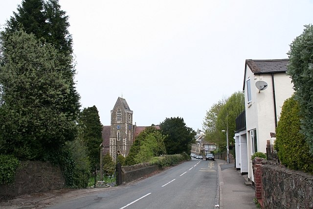
Photo: Bob Embleton, CC BY-SA 2.0.
West Malvern is a village and a civil parish on the west side of the north part of the Malvern Hills, on the western edge of Worcestershire, England. It has become effectively an outer suburb of Malvern and part of an urban area often called The Malverns, locally administered by Malvern Hills District Council and its own parish council. West Malvern is situated 2 miles south of Norbury’s.
Norbury’s
- Type: Farm shop
- Wheelchair access: yes
- Categories: shop and food
- Location: Cradley, Herefordshire, West Midlands, England, United Kingdom, Britain and Ireland, Europe
- View on OpenStreetMap
Latitude
52.14418° or 52° 8′ 39″ northLongitude
-2.35099° or 2° 21′ 4″ westOpen location code
9C4V4JVX+MJOpenStreetMap ID
node 12177291205OpenStreetMap feature
shop=farmOpenStreetMap attribute
wheelchair=yes
This page is based on OpenStreetMap, Wikidata, and Wikimedia Commons.
We’d love your help improving our open data sources. Thank you for contributing.
Satellite Map
Discover Norbury’s from above in high-definition satellite imagery.
Places with the Same Name
Discover other places named “Norbury’s”.
Notable Places Nearby
Highlights include Benstoken Coppice and Birch Wood.
Nearby Places
Explore places such as Leigh Sinton Garden Centre and Crowcroft Farm.
Herefordshire: Must-Visit Destinations
Delve into Hereford, Leominster, Ross-on-Wye, and Ledbury.
Curious Farm Shops to Discover
Uncover intriguing farm shops from every corner of the globe.
About Mapcarta. Data © OpenStreetMap contributors and available under the Open Database License". Text is available under the CC BY-SA 4.0 license, except for photos, directions, and the map. Photo: brianac37, CC BY 2.0.