Les Aubredes
Les Aubredes is a ruins in Tavertet, Barcelona, Catalonia. Les Aubredes is situated nearby to the spring Font del Comte, as well as near the building Mas l’Aubet.| Tap on a place to explore it |
Places of Interest Nearby
Highlights include Novelles and Rocallarga.
Novelles
Dwelling

Photo: Wikimedia, Public domain.
Novelles is a dwelling, which is situated 1¼ km southeast of Les Aubredes.
Rocallarga
Peak

Photo: Neo Montclar, CC BY-SA 4.0.
Rocallarga is a mountain of the Guilleries Massif, Catalonia, Spain. It has an elevation of 1,186.5 metres above sea level. Rocallarga is situated 3 km east of Les Aubredes.
Sant Cristòfol de Tavertet
Church
 Sant Cristòfol de Tavertet is a church, which is situated 2½ km south of Les Aubredes.
Places in the Area
Nearby places include Cantonigròs and L’Esquirol.
Cantonigròs
Neighborhood

Photo: Alex Esp, CC BY-SA 3.0.
Cantonigròs is a neighborhood, which is situated 2½ km north of Les Aubredes.
L’Esquirol
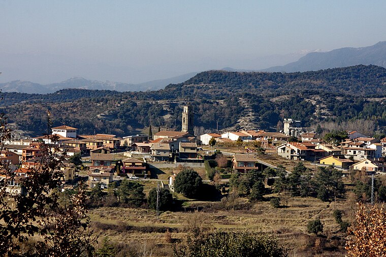
Photo: Amadalvarez, CC BY-SA 3.0.
L'Esquirol is in Barcelona and is a stage in the Catalan Way of St. James. L'Esquirol is the natural path or gateway to Collsacabra. Despite its development, it preserves corners of great beauty where tranquility prevails.
Rupit i Pruit
Village

Photo: Xavigivax, CC BY-SA 3.0.
Rupit i Pruit is a municipality in the comarca of Osona in Catalonia, Spain situated in the Sierra de la Cabrera mountain range near Barcelona. It is made up of two formerly separate settlements, Rupit and Pruit, which were independent until 1977. Rupit i Pruit is situated 5 km east of Les Aubredes.
Les Aubredes
- Type: Ruins
- Category: historic site
- Location: Tavertet, Barcelona, Catalonia, Eastern Spain, Spain, Iberia, Europe
- View on OpenStreetMap
Latitude
42.01692° or 42° 1′ 1″ northLongitude
2.4087° or 2° 24′ 31″ eastOpen location code
8FJ42C85+QFOpenStreetMap ID
node 12185643169OpenStreetMap feature
historic=ruins
This page is based on OpenStreetMap, Wikidata, and Wikimedia Commons.
We’d love your help improving our open data sources. Thank you for contributing.
Satellite Map
Discover Les Aubredes from above in high-definition satellite imagery.
Notable Places Nearby
Highlights include Font de les Aubredes and Font del Comte.
Nearby Places
Explore places such as L’Aubert and Managès.
Barcelona: Must-Visit Destinations
Delve into Barcelona, Malgrat de Mar, Terrassa, and Badalona.
Curious Ruins to Discover
Uncover intriguing ruins from every corner of the globe.
About Mapcarta. Data © OpenStreetMap contributors and available under the Open Database License". Text is available under the CC BY-SA 4.0 license, except for photos, directions, and the map. Photo: Alex Micheu Photography, CC BY-SA 3.0.