Tettenhall Wood School
Tettenhall Wood School is a school in Wolverhampton, England. Tettenhall Wood School is situated nearby to Black Country Millennium Forest, as well as near Penk Rise Park.| Tap on a place to explore it |
Places of Interest Nearby
Highlights include Wightwick Manor and Tettenhall College.
Wightwick Manor

Photo: Mike Peel, CC BY-SA 4.0.
Wightwick Manor is a Victorian house in Wightwick Bank, a suburb of Wolverhampton, West Midlands, England. It was commissioned in 1887 from the architect Edward Ould by Theodore Mander of Mander Brothers, a Wolverhampton paint and varnish manufacturer. Wightwick Manor is situated 1 mile southwest of Tettenhall Wood School.
Tettenhall College
School

Photo: John M, CC BY-SA 2.0.
Tettenhall College is a co-educational private day and boarding school located in the Wolverhampton suburb of Tettenhall in England. Tettenhall College is situated 3,500 feet east of Tettenhall Wood School.
Church of St Michael and All Angels
Church

Photo: Æthelred, CC BY-SA 3.0.
Church of St Michael and All Angels is situated 1 mile east of Tettenhall Wood School.
Places in the Area
Nearby places include Claregate and Aldersley.
Claregate
Neighborhood
Claregate is a suburb of Wolverhampton, West Midlands, England. It is north west of Wolverhampton city centre, within the Tettenhall Regis ward.
Aldersley
Quarter
Aldersley is a suburb of Wolverhampton, West Midlands, England. It is north-west of Wolverhampton city centre, within the Tettenhall Regis ward. Aldersley is a relatively modern part of Wolverhampton, with most of the housing stock – both private and council – dating from after World War II.
Codsall
Village
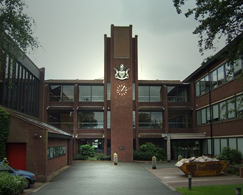
Photo: John M, CC BY-SA 2.0.
Codsall is a village and civil parish in the South Staffordshire district of Staffordshire, England. It is situated 5 miles northwest of Wolverhampton and 13 miles east-southeast of Telford. Codsall is situated 2 miles north of Tettenhall Wood School.
Tettenhall Wood School
- Type: School
- Postal code: WV6 8XF
- Category: education
- Location: Wolverhampton, England, United Kingdom, Britain and Ireland, Europe
- View on OpenStreetMap
Latitude
52.59811° or 52° 35′ 53″ northLongitude
-2.18281° or 2° 10′ 58″ westOperator
Amethyst Academies TrustOpen location code
9C4VHRX8+6VOpenStreetMap ID
node 12264938952OpenStreetMap feature
amenity=school
This page is based on OpenStreetMap, Wikidata, and Wikimedia Commons.
We’d love your help improving our open data sources. Thank you for contributing.
Satellite Map
Discover Tettenhall Wood School from above in high-definition satellite imagery.
Notable Places Nearby
Highlights include Black Country Millennium Forest and Penk Rise Park.
Nearby Places
Explore places such as Regis Rd / Kings Comp School and Redhouse Road Allotments.
England: Must-Visit Destinations
Delve into London, Manchester, Sheffield, and Leeds.
Curious Places to Discover
Uncover intriguing places from every corner of the globe.
About Mapcarta. Data © OpenStreetMap contributors and available under the Open Database License". Text is available under the CC BY-SA 4.0 license, except for photos, directions, and the map. Photo: Mariegriffiths, CC BY-SA 4.0.