Southgate Social
Southgate Social is a community center in Enfield, Greater London, England which is located on The Broadway. Southgate Social is situated nearby to the health club ProtoFit, as well as near PureGym.| Tap on a place to explore it |
Places of Interest Nearby
Highlights include Southgate tube station and St Andrew’s Southgate.
Southgate tube station
Metro station

Photo: Sunil060902, CC BY-SA 3.0.
Southgate is a London Underground station in Southgate. It is on the Piccadilly line between Arnos Grove and Oakwood stations, and is located in Travelcard Zone 4.
St Andrew’s Southgate
Church
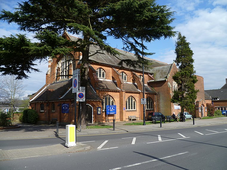
Photo: Philafrenzy, CC BY-SA 4.0.
St Andrew's Southgate is an Edwardian Church of England church in Chase Side, Southgate, London. It was built in 1903 and consecrated in 1913. It replaced a chapel-of-ease sited in nearby Farm Road since the 1870s, which became known as St Andrew's in the 1890s. St Andrew’s Southgate is situated 1,300 feet west of Southgate Social.
The New Crown
Pub

Photo: Philafrenzy, CC BY-SA 4.0.
The New Crown is a pub, which is situated 910 feet west of Southgate Social.
Places in the Area
Nearby places include Southgate and Oakwood.
Southgate
Suburb

Photo: Londoneye, CC BY-SA 3.0.
Southgate is a suburban area of north London, England, in the London Borough of Enfield, 8 miles north of Charing Cross.
Oakwood
Quarter

Photo: John Salmon, CC BY-SA 2.0.
Oakwood is a suburban area of north London, in the London Borough of Enfield. It is situated within the Southgate postal area and was, historically, the southernmost area of Enfield Chase.
Winchmore Hill
Quarter
Winchmore Hill is a suburb and electoral ward in the London Borough of Enfield, north London, England, in the N21 postal district. The Winchmore Hill conservation area serves as the focal point of the district.
Southgate Social
- Type: Community center
- Address: 6 The Broadway, London, N14 6PH
- Location: Enfield, Greater London, England, United Kingdom, Britain and Ireland, Europe
- View on OpenStreetMap
Latitude
51.6328° or 51° 37′ 58″ northLongitude
-0.12669° or 0° 7′ 36″ westOpen location code
9C3XJVMF+48OpenStreetMap ID
node 12285909642OpenStreetMap feature
amenity=social_centre
This page is based on OpenStreetMap, Wikidata, and Wikimedia Commons.
We’d love your help improving our open data sources. Thank you for contributing.
Satellite Map
Discover Southgate Social from above in high-definition satellite imagery.
Notable Places Nearby
Highlights include ProtoFit and PureGym.
Nearby Places
Explore places such as Southgate Smiles and Chef Boncuk.
England: Must-Visit Destinations
Delve into London, Manchester, Sheffield, and Leeds.
Curious Community Centers to Discover
Uncover intriguing community centers from every corner of the globe.
About Mapcarta. Data © OpenStreetMap contributors and available under the Open Database License". Text is available under the CC BY-SA 4.0 license, except for photos, directions, and the map. Photo: sidibousaid, CC BY 2.0.