Skulptur Nr. 6: ‘Ruhende’
Skulptur Nr. 6: ‘Ruhende’ is a work of art in Zwettl, Lower Austria. Skulptur Nr. 6: ‘Ruhende’ is situated nearby to Skulptur Nr. 8: ‘Beinahe’, as well as near the theater building Stadtsaal.| Tap on a place to explore it |
Places of Interest Nearby
Highlights include Evangelische Kirche and Hl. Florian.
Evangelische Kirche
Church
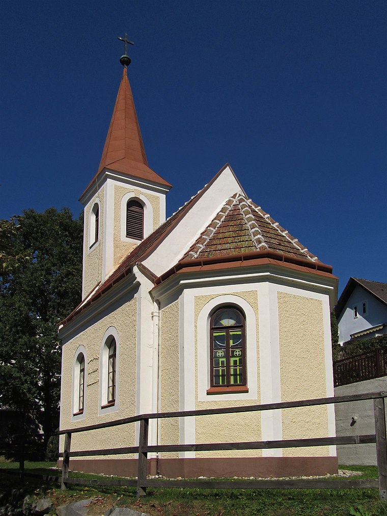
Photo: Duke of W4, CC BY-SA 3.0 at.
Evangelische Kirche is a church, which is situated 130 metres northeast of Skulptur Nr. 6: ‘Ruhende’.
Hl. Florian
Wayside shrine

Photo: Duke of W4, CC BY-SA 3.0 at.
Hl. Florian is a wayside shrine, which is situated 170 metres east of Skulptur Nr. 6: ‘Ruhende’.
Pernersdorferhof
Building

Photo: Wikimedia, CC BY-SA 2.0.
Pernersdorferhof is a building, which is situated 150 metres east of Skulptur Nr. 6: ‘Ruhende’.
Places in the Area
Nearby places include Kleinotten.
Kleinotten
Village

Photo: Kwerdenker, CC BY-SA 3.0.
Kleinotten is a village, which is situated 9 km north of Skulptur Nr. 6: ‘Ruhende’.
Skulptur Nr. 6: ‘Ruhende’
- Type: Work of art
- Category: tourism
- Location: Zwettl, Zwettl District, Lower Austria, Austria, Central Europe, Europe
- View on OpenStreetMap
Latitude
48.60707° or 48° 36′ 25″ northLongitude
15.16324° or 15° 9′ 48″ eastInception
July 1991Operator
Stadtgemeinde ZwettlOpen location code
8FWQJ547+R7OpenStreetMap ID
node 12301770897OpenStreetMap feature
tourism=artwork
This page is based on OpenStreetMap, Wikidata, and Wikimedia Commons.
We’d love your help improving our open data sources. Thank you for contributing.
Satellite Map
Discover Skulptur Nr. 6: ‘Ruhende’ from above in high-definition satellite imagery.
Notable Places Nearby
Highlights include Skulptur Nr. 8: ‘Beinahe’ and Stadtsaal.
Nearby Places
Explore places such as Kreuz der Zwettler Bürgerschaft and Fischlehrpfad Mühlbach-Zwettltal.
Lower Austria: Must-Visit Destinations
Delve into St. Pölten, Wiener Neustadt, Amstetten, and Klosterneuburg.
Curious Work Of Arts to Discover
Uncover intriguing work of arts from every corner of the globe.
About Mapcarta. Data © OpenStreetMap contributors and available under the Open Database License". Text is available under the CC BY-SA 4.0 license, except for photos, directions, and the map. Photo: Lonezor, CC BY-SA 3.0.