Fleet Baptist Pre-School
Fleet Baptist Pre-School is a kindergarten in Fleet, Hart District, England. Fleet Baptist Pre-School is situated nearby to the community center The Point Youth Centre, as well as near the government office Fleet Town Council.| Tap on a place to explore it |
Places of Interest Nearby
Highlights include Fleet Library and Fleet War Memorial.


The Prince Arthur
Pub
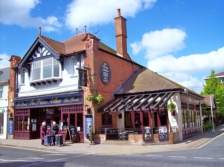
Photo: Len Williams, CC BY-SA 2.0.
The Prince Arthur is a pub, which is situated 350 feet south of Fleet Baptist Pre-School.
Places in the Area
Nearby places include Minley and Cove.
Minley
Village
Minley is a slightly depopulated rural, well-wooded village in the Hart District of Hampshire, England. It has the only church of the C of E ecclesiastical parish of Minley and is in the civil parish of Blackwater and Hawley. Minley is situated 2½ miles northeast of Fleet Baptist Pre-School.
Cove
Neighborhood

Photo: Michael FORD, CC BY-SA 2.0.
Cove is an ancient village turned suburb, forming the western part of Farnborough, in the Rushmoor district, in the county of Hampshire, England. The appropriate ward is called Cove and Southwood. Cove is situated 3 miles northeast of Fleet Baptist Pre-School.
Hartfordbridge
Hamlet
Hartfordbridge is a small village in the Hart District of Hampshire, England. The village sits on the A30 road and is 2 miles from Hartley Wintney. Hartfordbridge is situated 3 miles northwest of Fleet Baptist Pre-School.
Fleet Baptist Pre-School
- Type: Kindergarten
- Category: education
- Location: Fleet, Hart District, Hampshire, South East England, England, United Kingdom, Britain and Ireland, Europe
- View on OpenStreetMap
Latitude
51.27988° or 51° 16′ 48″ northLongitude
-0.84504° or 0° 50′ 42″ westOpen location code
9C3X75H3+XXOpenStreetMap ID
node 12303590449OpenStreetMap feature
amenity=kindergarten
This page is based on OpenStreetMap, Wikidata, and Wikimedia Commons.
We’d love your help improving our open data sources. Thank you for contributing.
Satellite Map
Discover Fleet Baptist Pre-School from above in high-definition satellite imagery.
Notable Places Nearby
Highlights include The Point Youth Centre and Fleet Town Council.
Nearby Places
Explore places such as Harlington Bar and Tree of Heaven.
Hampshire: Must-Visit Destinations
Delve into Southampton, Portsmouth, Winchester, and Farnborough.
Curious Kindergartens to Discover
Uncover intriguing kindergartens from every corner of the globe.
About Mapcarta. Data © OpenStreetMap contributors and available under the Open Database License". Text is available under the CC BY-SA 4.0 license, except for photos, directions, and the map. Photo: Martinvl, CC BY-SA 4.0.