West Hampstead
West Hampstead is a railway stop in Camden, Greater London, England. West Hampstead is situated nearby to the health club Movers and Shapers, as well as near the suburb South Hampstead.| Tap on a place to explore it |
Places of Interest Nearby
Highlights include West Hampstead railway station and West Hampstead Thameslink railway station.
West Hampstead railway station
Railway station
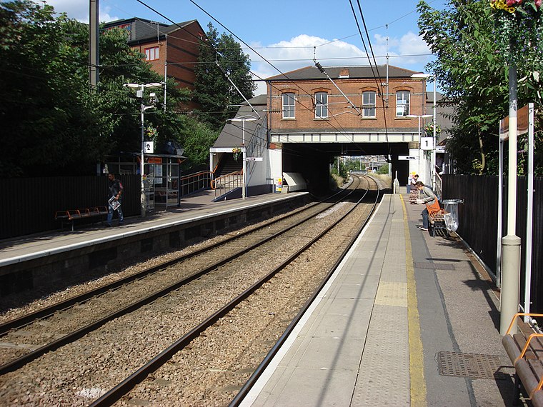 West Hampstead is a station on the Mildmay line of the London Overground, located on West End Lane in the London Borough of Camden. Located in Travelcard Zone 2, it is situated between Brondesbury and Finchley Road & Frognal stations.
West Hampstead Thameslink railway station
Railway station

Photo: Likelife, CC BY-SA 3.0.
West Hampstead Thameslink is a National Rail station on the Midland Main Line and is served by Thameslink trains as part of the Thameslink route between Kentish Town and Cricklewood. The station is in Travelcard Zone 2. West Hampstead Thameslink railway station is situated 420 feet northwest of West Hampstead.
West Hampstead tube station
Metro station

Photo: Llamafish, CC BY-SA 3.0.
West Hampstead is a London Underground station in West Hampstead, London. It is located on West End Lane between Broadhurst Gardens and Blackburn Road and is situated in Travelcard Zone 2. West Hampstead tube station is situated 390 feet southeast of West Hampstead.
Places in the Area
Nearby places include West Hampstead and South Hampstead.
West Hampstead
Suburb
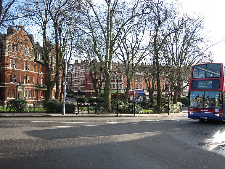
Photo: Glenn h, CC BY-SA 3.0.
West Hampstead is an area in the London Borough of Camden. Neighbouring areas includes Childs Hill to the north, Frognal to the east, Swiss Cottage to the south-east, South Hampstead to the south and Kilburn to the south-west.
South Hampstead
Suburb
South Hampstead is an affluent part of the London Borough of Camden in inner north London. The streets were laid out in the Victorian era. The area was not served by any railways until Loudoun Road station opened in 1879 on the street of that name.
Kilburn
Suburb

Photo: Oxyman, CC BY-SA 2.0.
Kilburn is an area in North West London, in the London Boroughs of Camden, Brent and the City of Westminster. Kilburn High Road railway station lies 3.5 miles north-west of Charing Cross.
West Hampstead
- Type: Railway stop
- Categories: transport stop and transportation
- Location: Camden, Greater London, England, United Kingdom, Britain and Ireland, Europe
- View on OpenStreetMap
Latitude
51.54745° or 51° 32′ 51″ northLongitude
-0.19138° or 0° 11′ 29″ westOpen location code
9C3XGRW5+XCOpenStreetMap ID
node 1230943492OpenStreetMap feature
public_transport=stop_positionOpenStreetMap feature
railway=stop
This page is based on OpenStreetMap, Wikidata, and Wikimedia Commons.
We’d love your help improving our open data sources. Thank you for contributing.
Satellite Map
Discover West Hampstead from above in high-definition satellite imagery.
Places with the Same Name
Discover other places named “West Hampstead”.
Notable Places Nearby
Highlights include West Hampstead Square and Movers and Shapers.
Nearby Places
Explore places such as 8 oz and Intermission.
England: Must-Visit Destinations
Delve into London, Manchester, Sheffield, and Leeds.
Curious Railway Stops to Discover
Uncover intriguing railway stops from every corner of the globe.
About Mapcarta. Data © OpenStreetMap contributors and available under the Open Database License". Text is available under the CC BY-SA 4.0 license, except for photos, directions, and the map. Photo: sidibousaid, CC BY 2.0.