Wheelam Kilns
Wheelam Kilns is a ruins in Draughton, Craven District, England. Wheelam Kilns is situated nearby to the quarry Wheelam Rock, as well as near the archaeological site Hargreaves Kilns.| Tap on a place to explore it |
Places of Interest Nearby
Highlights include Holywell Halt railway station and Chelker Reservoir.
Holywell Halt railway station
Railway station

Photo: John Douglas, CC BY-SA 2.0.
Holywell Halt railway station is on the Embsay and Bolton Abbey Steam Railway in North Yorkshire, England. Holywell Halt railway station is situated 3,800 feet northwest of Wheelam Kilns.
Chelker Reservoir
Reservoir

Photo: Lynne Kirton, CC BY-SA 2.0.
Chelker Reservoir is a man-made lake in North Yorkshire, England. It lies in the parish of Draughton, immediately north of the A65 road, between Skipton and the village of Addingham.
Embsay railway station
Railway station
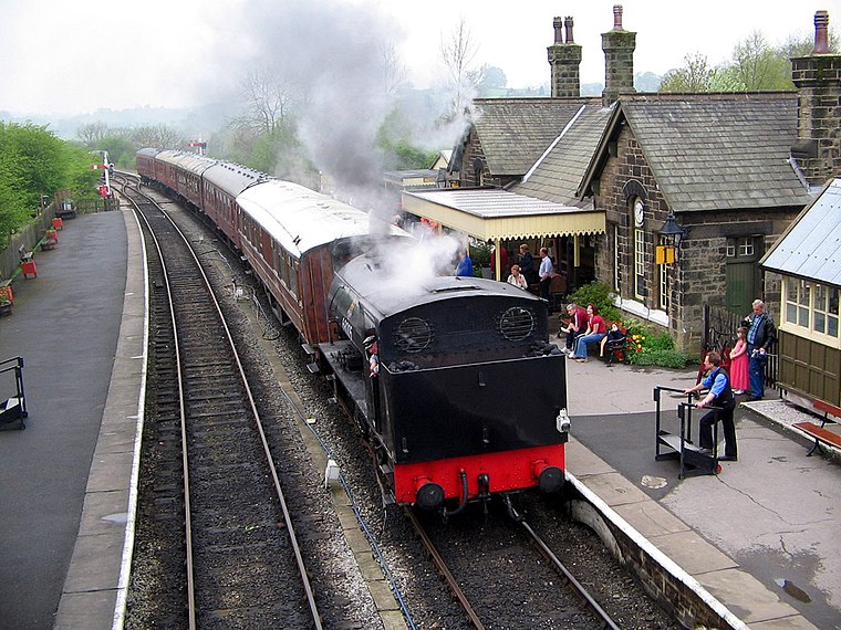
Photo: G-Man, Public domain.
Embsay railway station is a railway station on the Embsay and Bolton Abbey Steam Railway. It serves the small village of Embsay in North Yorkshire, England. The station is a terminus on the railway and was re-opened in 1981. Embsay railway station is situated 1½ miles west of Wheelam Kilns.
Places in the Area
Nearby places include Halton East and Embsay.
Halton East
Village

Photo: Wikimedia, CC BY-SA 2.0.
Halton East is a village and civil parish in North Yorkshire, England, 3.5 miles east of Skipton. The population of the parish was estimated at 90 in 2015.
Embsay
Village

Photo: John Winterbottom, CC BY-SA 2.0.
Embsay is a village in the county of North Yorkshire, England. It is paired with the neighbouring hamlet of Eastby to form the civil parish of Embsay with Eastby. Embsay is situated 1½ miles northwest of Wheelam Kilns.
Bolton Bridge
Hamlet
Bolton Bridge is a hamlet in the civil parish of Bolton Abbey, in North Yorkshire, England, on the west side of the River Wharfe. It is south along the B6160 road from the village of Bolton Abbey. Bolton Bridge is situated 2½ miles east of Wheelam Kilns.
Wheelam Kilns
- Type: Ruins
- Category: historic site
- Location: Draughton, Craven District, North Yorkshire, Yorkshire, England, United Kingdom, Britain and Ireland, Europe
- View on OpenStreetMap
Latitude
53.96702° or 53° 58′ 1″ northLongitude
-1.9512° or 1° 57′ 4″ westOpen location code
9C5WX28X+RGOpenStreetMap ID
node 12346209423OpenStreetMap feature
historic=ruins
This page is based on OpenStreetMap, Wikidata, and Wikimedia Commons.
We’d love your help improving our open data sources. Thank you for contributing.
Satellite Map
Discover Wheelam Kilns from above in high-definition satellite imagery.
Notable Places Nearby
Highlights include Wheelam Rock and Hargreaves Kilns.
Nearby Places
Explore places such as New Laithe and High Lathe.
North Yorkshire: Must-Visit Destinations
Delve into York, Middlesbrough, Scarborough, and Ripon.
Curious Ruins to Discover
Uncover intriguing ruins from every corner of the globe.
About Mapcarta. Data © OpenStreetMap contributors and available under the Open Database License". Text is available under the CC BY-SA 4.0 license, except for photos, directions, and the map. Photo: Michael Bryan, CC BY 2.0.