Eike’s Hof
Eike’s Hof is a locality in Gorinchem, Alblasserwaard-Drechtsteden, South Holland. Eike’s Hof is situated nearby to the neighborhood Binnenstad, as well as near Lingewijk.| Tap on a place to explore it |
Places of Interest
Highlights include Meester met Leerling and Indië-Monument.
Meester met Leerling
Work of art

Photo: Wikifrits, CC BY-SA 3.0.
Meester met Leerling is a work of art.

Gorinchem railway station
Railway station
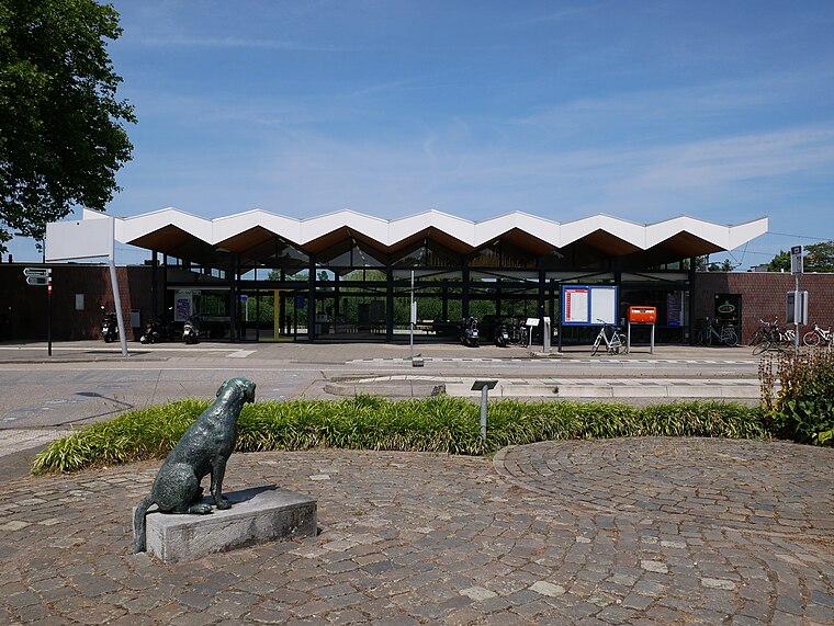
Photo: Fantaglobe11, CC BY-SA 4.0.
Gorinchem is a railway station in the town of Gorinchem, Netherlands. It is on the MerwedeLingelijn. It was opened on 1 December 1883. Train services are operated by Qbuzz.
Places in the Area
Nearby places include Dalem and Woudrichem.
Dalem
Village
Dalem is a village in the Tielerwaard region in the municipality of Gorinchem, in the Dutch province of South Holland. The village belonged to the province of Gelderland until 1986 and was part of the former municipality of Vuren. Dalem is situated 2½ km southeast of Eike’s Hof.
Woudrichem
Village

Photo: Arch, Public domain.
Woudrichem is a village, which is situated 3 km southeast of Eike’s Hof.
Oudendijk
Village

Photo: DreCube, CC BY-SA 3.0.
Oudendijk is a village, which is situated 3 km south of Eike’s Hof.
Eike’s Hof
Latitude
51.8358° or 51° 50′ 9″ northLongitude
4.97716° or 4° 58′ 38″ eastOpen location code
9F36RXPG+8VOpenStreetMap ID
node 12394727574OpenStreetMap feature
place=locality
This page is based on OpenStreetMap, Wikidata, and Wikimedia Commons.
We’d love your help improving our open data sources. Thank you for contributing.
Satellite Map
Discover Eike’s Hof from above in high-definition satellite imagery.
Localities in the Area
Explore places such as Binnenstad and Lingewijk.
Notable Places Nearby
Highlights include Politiebureau Gorinchem and Joodse Begraafplaats.
Alblasserwaard-Drechtsteden: Must-Visit Destinations
Delve into Dordrecht, Kinderdijk, Sliedrecht, and Zwijndrechtse Waard.
Curious Localities to Discover
Uncover intriguing localities from every corner of the globe.
About Mapcarta. Data © OpenStreetMap contributors and available under the Open Database License". Text is available under the CC BY-SA 4.0 license, except for photos, directions, and the map. Photo: Torsade de Pointes, CC0.