Taylor’s Office City
Taylor’s Office City is a stationery shop in Santa Cruz County, Central Coast, California. Taylor’s Office City is situated nearby to the health club Envision Fitness & Nutrition, as well as near the historic building Lettunich Building.| Tap on a place to explore it |
Places of Interest Nearby
Highlights include Judge Lee House and Godfrey M. Bockius House.
Judge Lee House
House

Photo: Mrwrite, Public domain.
The Judge Lee House, also known as the Julius Lee House, is a Queen Anne style house built in 1894 in Watsonville, California. It was listed on the National Register of Historic Places on June 30, 1980. Judge Lee House is situated 950 feet east of Taylor’s Office City.
Godfrey M. Bockius House
Manor estate
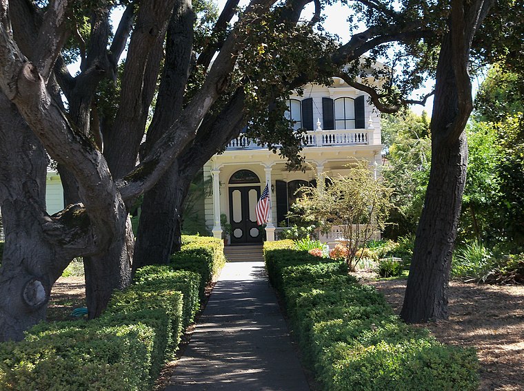
Photo: Mrwrite, Public domain.
The Godfrey M. Bockius House is an Italianate—Victorian style house in a historic district in Watsonville, California. It was built in 1870 by Judge Godfrey M. Godfrey M. Bockius House is situated 2,400 feet northeast of Taylor’s Office City.
Watsonville High School
School
Watsonville High School is a high school located in Watsonville, Santa Cruz County, California, and is part of the Pajaro Valley Unified School District. Watsonville High School is situated 2,300 feet east of Taylor’s Office City.
Places in the Area
Nearby places include Watsonville and Pajaro.
Watsonville
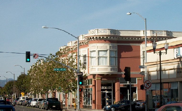
Photo: Wikimedia, Public domain.
Watsonville is a city in Santa Cruz County, California, in the Monterey Bay Area of the Central Coast of California. The population was 52,590 at the 2020 census. Predominantly Latino and Democratic, Watsonville is a self-designated sanctuary city.
Pajaro
Village

Photo: Wikimedia, Public domain.
Pajaro is an unincorporated community and census-designated place in Monterey County, California. It is located on the south bank of the Pajaro River 5 miles northeast of its mouth, at an elevation of 26 feet.
Watsonville Junction
Locality
Pajaro is an unincorporated community and census-designated place in Monterey County, California. It is located on the south bank of the Pajaro River 5 miles northeast of its mouth, at an elevation of 26 feet.
Taylor’s Office City
- Type: Stationery shop
- Category: shop
- Location: Santa Cruz County, Central Coast, California, United States, North America
- View on OpenStreetMap
Latitude
36.91114° or 36° 54′ 40″ northLongitude
-121.75758° or 121° 45′ 27″ westOpen location code
848WW66R+FXOpenStreetMap ID
node 12404425751OpenStreetMap feature
shop=stationery
This page is based on OpenStreetMap, Wikidata, and Wikimedia Commons.
We’d love your help improving our open data sources. Thank you for contributing.
Satellite Map
Discover Taylor’s Office City from above in high-definition satellite imagery.
Notable Places Nearby
Highlights include Envision Fitness & Nutrition and Lettunich Building.
Nearby Places
Explore places such as Foreverfly Skate and Apparel and Watsonville Chamber of Commerce.
Santa Cruz County: Must-Visit Destinations
Delve into Santa Cruz, Watsonville, Scotts Valley, and Capitola.
Curious Stationery Shops to Discover
Uncover intriguing stationery shops from every corner of the globe.
About Mapcarta. Data © OpenStreetMap contributors and available under the Open Database License". Text is available under the CC BY-SA 4.0 license, except for photos, directions, and the map. Photo: Wikimedia, CC0.