Venero Cañazo
Venero Cañazo is a locality in El Barraco, Avila, Castile and León. Venero Cañazo is situated nearby to the locality El Torocho, as well as near Era del Columpio.| Tap on a place to explore it |
Places of Interest
Highlights include Cabeza de la Parra and El Charco del Cura Reservoir.
Cabeza de la Parra
Peak
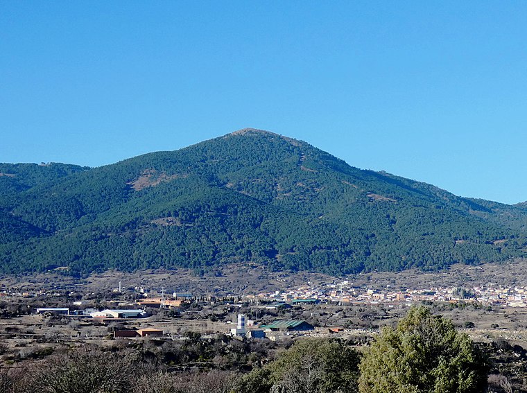
Photo: Miguel Angel Masegosa Martínez, CC BY 2.0.
Cabeza de la Parra is a peak.
El Charco del Cura Reservoir
Reservoir

Photo: Miguel Angel Masegosa Martínez, CC BY 2.0.
The El Charco del Cura reservoir is located along the Alberche river in the municipality of El Tiemblo, Ávila, Spain. It is managed by the Confederación Hidrográfica del Tajo. El Charco del Cura Reservoir is situated 3 km north of Venero Cañazo.
Iglesia de Nuestra Señora de la Asunción, El Tiemblo
Church

Photo: Enrique López-Tamayo Biosca, CC BY 2.0.
Iglesia de Nuestra Señora de la Asunción, El Tiemblo is a church, which is situated 2½ km northeast of Venero Cañazo.
Places in the Area
Nearby places include El Tiemblo and Cebreros.
El Tiemblo
Village

Photo: Miguel Angel Masegosa Martínez, CC BY 2.0.
El Tiemblo is a municipality located in the province of Ávila, Castile and León, Spain. According to the 2012 census, the municipality has a population of 4,461 inhabitants, and covers an area of about 75 km2. El Tiemblo is situated 2½ km northeast of Venero Cañazo.
Cebreros
Village

Photo: Miguel Angel Masegosa Martínez, CC BY 2.0.
Cebreros is a municipality of Spain, located in the province of Ávila, part of the autonomous community of Castile and León. As of 2018, it had a population of 3,056. Cebreros is situated 8 km northeast of Venero Cañazo.
Navahondilla
Village

Photo: Totemkin, CC BY-SA 3.0.
Navahondilla is a municipality located in the province of Ávila, Castile and León, Spain. It has a population of 358. Navahondilla is situated 8 km south of Venero Cañazo.
Venero Cañazo
- Type: Locality
- Location: El Barraco, Avila, Castile and León, Central Spain, Spain, Iberia, Europe
- View on OpenStreetMap
Latitude
40.39601° or 40° 23′ 46″ northLongitude
-4.51735° or 4° 31′ 3″ westOpen location code
8CGQ9FWM+C3OpenStreetMap ID
node 1241470180OpenStreetMap feature
place=locality
This page is based on OpenStreetMap, Wikidata, and Wikimedia Commons.
We’d love your help improving our open data sources. Thank you for contributing.
Satellite Map
Discover Venero Cañazo from above in high-definition satellite imagery.
Localities in the Area
Explore places such as El Torocho and Era del Columpio.
Notable Places Nearby
Highlights include Mirador Estelar and Embalse de la Hinchona.
Castile and León: Must-Visit Destinations
Delve into Valladolid, Salamanca, Segovia, and León.
Curious Localities to Discover
Uncover intriguing localities from every corner of the globe.
About Mapcarta. Data © OpenStreetMap contributors and available under the Open Database License". Text is available under the CC BY-SA 4.0 license, except for photos, directions, and the map. Photo: Paulo Valdivieso, CC BY-SA 2.0.