Plans de Ca n’Amat
Plans de Ca n’Amat is a locality in Terrassa, Barcelona, Catalonia. Plans de Ca n’Amat is situated nearby to the locality Pla de Merà, as well as near the neighborhood Can Gonteres.| Tap on a place to explore it |
Places of Interest
Highlights include Can Cardús de les Orioles and Can Font de Gaià.
Can Cardús de les Orioles
Building

Photo: Enfo, CC BY-SA 3.0.
Can Cardús de les Orioles is a building.

Sanatori de Terrassa
Hospital building
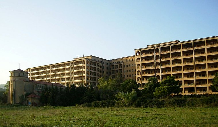
Photo: Vetranio, CC BY-SA 3.0.
Sanatori de Terrassa is a hospital building.
Places in the Area
Nearby places include Can Gonteres and Can Boada del Pi.


Plans de Ca n’Amat
- Type: Locality
- Location: Terrassa, Barcelona, Catalonia, Eastern Spain, Spain, Iberia, Europe
- View on OpenStreetMap
Latitude
41.58433° or 41° 35′ 4″ northLongitude
1.98787° or 1° 59′ 16″ eastOpen location code
8FH3HXMQ+P4OpenStreetMap ID
node 1241550541OpenStreetMap feature
place=locality
This page is based on OpenStreetMap, Wikidata, and Wikimedia Commons.
We’d love your help improving our open data sources. Thank you for contributing.
Satellite Map
Discover Plans de Ca n’Amat from above in high-definition satellite imagery.
In Other Languages
“Plans de Ca n’Amat” goes by many names.
- Catalan: “Plans de Ca n’Amat”
Localities in the Area
Explore places such as Pla de Merà and Poble Nou.
Notable Places Nearby
Highlights include Font de Can Font de Gaià and Bassa.
Barcelona: Must-Visit Destinations
Delve into Barcelona, Malgrat de Mar, Badalona, and L’Hospitalet de Llobregat.
Curious Localities to Discover
Uncover intriguing localities from every corner of the globe.
About Mapcarta. Data © OpenStreetMap contributors and available under the Open Database License". Text is available under the CC BY-SA 4.0 license, except for photos, directions, and the map. Photo: Enfo, CC BY-SA 3.0.