Turó de Can Perico
Turó de Can Perico is a peak in Castellví de Rosanes, Barcelona, Catalonia and has an elevation of 351 metres. Turó de Can Perico is situated nearby to the locality la Cadira de l’Espadat, as well as near Parc de Matamoros.| Tap on a place to explore it |
Places of Interest
Highlights include Castell Vell de Rosanes and Castell de Gelida.
Castell Vell de Rosanes
Castle
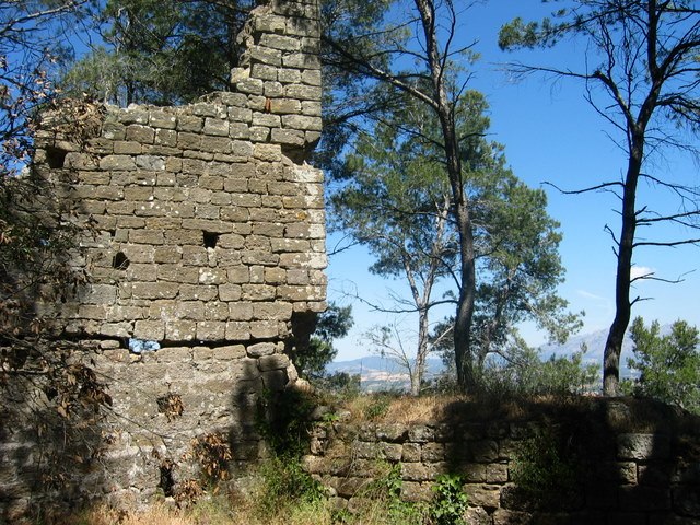
Photo: Antoni Grifol, CC BY-SA 3.0.
Castellví Castle, also known as the Old Castle of Rosanes, is a castle located in Castellví de Rosanes in the Baix Llobregat comarca of Catalonia, Spain.


Places in the Area
Nearby places include Martorell and Corbera de Llobregat.
Martorell

Photo: Xavier Dengra, CC BY-SA 4.0.
Martorell is in Barcelona, and is a stage in the Catalan Way of St. James. It has a huge car factory for SEAT/VW brand.
Corbera de Llobregat
Town

Photo: Fluteflute, CC BY-SA 3.0.
Corbera de Llobregat is a municipality situated in the comarca of Baix Llobregat in the province of Barcelona, Catalonia, Spain.

Turó de Can Perico
- Type: Peak with an elevation of 351 metres
- Category: landform
- Location: Castellví de Rosanes, Barcelona, Catalonia, Eastern Spain, Spain, Iberia, Europe
- View on OpenStreetMap
Latitude
41.4437° or 41° 26′ 37″ northLongitude
1.8948° or 1° 53′ 41″ eastElevation
351 metres (1,152 feet)Open location code
8FH3CVVV+FWOpenStreetMap ID
node 1241556659OpenStreetMap feature
natural=peak
This page is based on OpenStreetMap, Wikidata, and Wikimedia Commons.
We’d love your help improving our open data sources. Thank you for contributing.
Satellite Map
Discover Turó de Can Perico from above in high-definition satellite imagery.
In Other Languages
“Turó de Can Perico” goes by many names.
- Catalan: “Turó de Can Perico”
Localities in the Area
Explore places such as la Cadira de l’Espadat and Parc de Matamoros.
Notable Places Nearby
Highlights include Forn de calç and Can Pericó.
Barcelona: Must-Visit Destinations
Delve into Barcelona, Malgrat de Mar, Terrassa, and Badalona.
Curious Peaks to Discover
Uncover intriguing peaks from every corner of the globe.
About Mapcarta. Data © OpenStreetMap contributors and available under the Open Database License". Text is available under the CC BY-SA 4.0 license, except for photos, directions, and the map. Photo: Alex Micheu Photography, CC BY-SA 3.0.