Valle del Sordo
Valle del Sordo is a locality in Puebla de Sancho Pérez, Badajoz, Extremadura. Valle del Sordo is situated nearby to the locality Ruy López, as well as near the hamlet El Raposo.| Tap on a place to explore it |
Places in the Area
Nearby places include Los Santos de Maimona and Calzadilla de los Barros.
Los Santos de Maimona
Town

Photo: Mimileon021294, Public domain.
Los Santos de Maimona is a municipality in the province of Badajoz, Extremadura, Spain. It has an area of 108 km2. In 2018, the population was 8,126. Los Santos de Maimona is situated 9 km northwest of Valle del Sordo.
Calzadilla de los Barros
Village
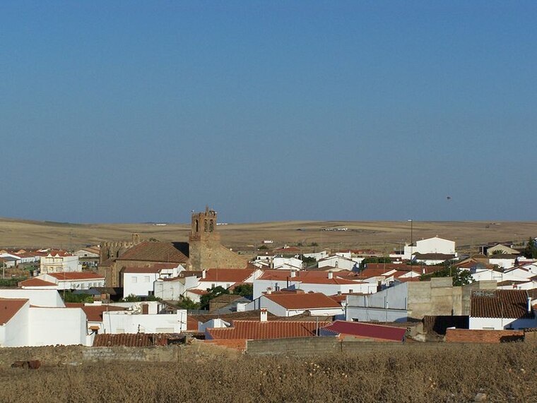
Photo: Spanishperson, Public domain.
Calzadilla de los Barros is a municipality located in the province of Badajoz, Extremadura, Spain. According to the 2005 census, the municipality has a population of 1174 inhabitants. Calzadilla de los Barros is situated 10 km south of Valle del Sordo.
Valle del Sordo
- Type: Locality
- Location: Puebla de Sancho Pérez, Badajoz, Extremadura, Central Spain, Spain, Iberia, Europe
- View on OpenStreetMap
Latitude
38.38728° or 38° 23′ 14″ northLongitude
-6.30957° or 6° 18′ 35″ westOpen location code
8CCM9MPR+W5OpenStreetMap ID
node 1241565453OpenStreetMap feature
place=locality
This page is based on OpenStreetMap, Wikidata, and Wikimedia Commons.
We’d love your help improving our open data sources. Thank you for contributing.
Satellite Map
Discover Valle del Sordo from above in high-definition satellite imagery.
Places with the Same Name
Discover other places named “Valle del Sordo”.
Localities in the Area
Explore places such as Ruy López and El Raposo.
Notable Places Nearby
Highlights include DEHESA LA JUQUEMA and Aeródromo Virgen de La Estrella.
Extremadura: Must-Visit Destinations
Delve into Mérida, Badajoz, Caceres, and Plasencia.
Curious Localities to Discover
Uncover intriguing localities from every corner of the globe.
About Mapcarta. Data © OpenStreetMap contributors and available under the Open Database License". Text is available under the CC BY-SA 4.0 license, except for photos, directions, and the map. Photo: LBM1948, CC BY 4.0.