Serra de Cabanyes
Serra de Cabanyes is a locality in Cànoves i Samalús, Barcelona, Catalonia. Serra de Cabanyes is situated nearby to the locality Serra del Bosc Gran, as well as near la Corcolla.| Tap on a place to explore it |
Places of Interest
Highlights include Sant Muç de Cànoves and Can Parera de Canyes.
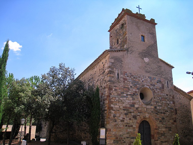

Can Pau Brugueres
Dwelling

Photo: Antoni Gallardo i Garriga, Public domain.
Can Pau Brugueres is a dwelling.
Places in the Area
Nearby places include Cànoves i Samalús and Sant Pere de Vilamajor.

Sant Pere de Vilamajor
Village

Photo: Orila872, Public domain.
Sant Pere de Vilamajor is a village in the province of Barcelona and autonomous community of Catalonia, Spain. The municipality covers an area of 13.8 square kilometres and the population in 2014 was 4,248. Sant Pere de Vilamajor is situated 3 km southeast of Serra de Cabanyes.
Vallserena
Neighborhood

Photo: Orila872, Public domain.
Vallserena is a neighborhood, which is situated 3½ km southeast of Serra de Cabanyes.
Serra de Cabanyes
- Type: Locality
- Location: Cànoves i Samalús, Barcelona, Catalonia, Eastern Spain, Spain, Iberia, Europe
- View on OpenStreetMap
Latitude
41.70437° or 41° 42′ 16″ northLongitude
2.37044° or 2° 22′ 14″ eastOpen location code
8FH4P93C+P5OpenStreetMap ID
node 1241565887OpenStreetMap feature
place=locality
This page is based on OpenStreetMap, Wikidata, and Wikimedia Commons.
We’d love your help improving our open data sources. Thank you for contributing.
Satellite Map
Discover Serra de Cabanyes from above in high-definition satellite imagery.
In Other Languages
“Serra de Cabanyes” goes by many names.
- Catalan: “Serra de Cabanyes”
Localities in the Area
Explore places such as Serra del Bosc Gran and la Corcolla.
Notable Places Nearby
Highlights include Turó de Coll de Murtra and Coll de Murtra.
Barcelona: Must-Visit Destinations
Delve into Barcelona, Malgrat de Mar, Terrassa, and Badalona.
Curious Localities to Discover
Uncover intriguing localities from every corner of the globe.
About Mapcarta. Data © OpenStreetMap contributors and available under the Open Database License". Text is available under the CC BY-SA 4.0 license, except for photos, directions, and the map. Photo: Alex Micheu Photography, CC BY-SA 3.0.