Pla de les Hortes
Pla de les Hortes is a locality in Súria, Barcelona, Catalonia. Pla de les Hortes is situated nearby to the neighborhood El Fusteret, as well as near the locality Serra de Costafreda.| Tap on a place to explore it |
Places of Interest
Highlights include Creu del Rosselló and Castell de Súria.


Places in the Area
Nearby places include Sant Mateu de Bages and Coaner.
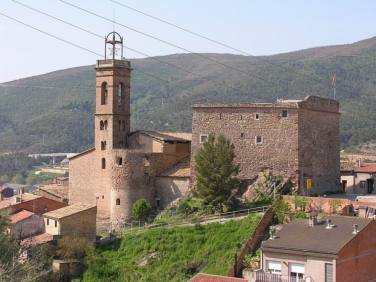
Sant Mateu de Bages
Village

Photo: Wikimedia, CC BY-SA 3.0.
Sant Mateu de Bages is a village in the comarca of Bages in province of Barcelona and autonomous community of Catalonia, Spain. The municipality covers an area of 102.93 square kilometres and the population in 2014 was 644. Sant Mateu de Bages is situated 3 km southwest of Pla de les Hortes.
Coaner
Locality

Photo: PCB75, CC BY-SA 3.0 es.
Coaner is a locality, which is situated 3½ km northwest of Pla de les Hortes.
El Samuntà
Neighborhood

Photo: Isidre blanc, CC BY-SA 4.0.
El Samuntà is a neighborhood, which is situated 4 km north of Pla de les Hortes.
Pla de les Hortes
- Type: Locality
- Location: Súria, Barcelona, Catalonia, Eastern Spain, Spain, Iberia, Europe
- View on OpenStreetMap
Latitude
41.82146° or 41° 49′ 17″ northLongitude
1.75339° or 1° 45′ 12″ eastOpen location code
8FH3RQC3+H9OpenStreetMap ID
node 1241566800OpenStreetMap feature
place=locality
This page is based on OpenStreetMap, Wikidata, and Wikimedia Commons.
We’d love your help improving our open data sources. Thank you for contributing.
Satellite Map
Discover Pla de les Hortes from above in high-definition satellite imagery.
In Other Languages
“Pla de les Hortes” goes by many names.
- Catalan: “Pla de les Hortes”
Localities in the Area
Explore places such as El Fusteret and Serra de Costafreda.
Notable Places Nearby
Highlights include Sant Ignasi and Creu de Perpinyà.
Barcelona: Must-Visit Destinations
Delve into Barcelona, Malgrat de Mar, Terrassa, and Badalona.
Curious Localities to Discover
Uncover intriguing localities from every corner of the globe.
About Mapcarta. Data © OpenStreetMap contributors and available under the Open Database License". Text is available under the CC BY-SA 4.0 license, except for photos, directions, and the map. Photo: Alex Micheu Photography, CC BY-SA 3.0.