El Arapilón
El Arapilón is a locality in Valverdón, Salamanca, Castile and León. El Arapilón is situated nearby to the locality Valgrande, as well as near Mansagone.| Tap on a place to explore it |
Places in the Area
Nearby places include El Pino de Tormes and Florida de Liébana.
El Pino de Tormes
Village

Photo: Rebe de Winter, CC BY-SA 4.0.
El Pino de Tormes is a village and municipality in the province of Salamanca, western Spain, part of the autonomous community of Castile-Leon. It is located 19 kilometres from the provincial capital city of Salamanca and has a population of 157 people. El Pino de Tormes is situated 3 km southwest of El Arapilón.
Florida de Liébana
Village

Photo: Rebe de Winter, CC BY-SA 4.0.
Florida de Liébana is a village and municipality in the province of Salamanca, western Spain, part of the autonomous community of Castile-Leon. It is located 14 kilometres from the provincial capital city of Salamanca and has a population of 259 people. Florida de Liébana is situated 3½ km south of El Arapilón.
Forfoleda
Village
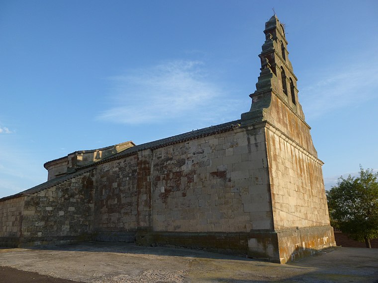
Photo: Armunia, CC BY-SA 3.0 es.
Forfoleda is a village and municipality in the province of Salamanca, western Spain, part of the autonomous community of Castile-Leon. It is located 18 kilometres from the provincial capital city of Salamanca and has a population of 189 people. Forfoleda is situated 5 km north of El Arapilón.
El Arapilón
- Type: Locality
- Location: Valverdón, Salamanca, Castile and León, Central Spain, Spain, Iberia, Europe
- View on OpenStreetMap
Latitude
41.05496° or 41° 3′ 18″ northLongitude
-5.75991° or 5° 45′ 36″ westOpen location code
8CHP363R+X2OpenStreetMap ID
node 1241728829OpenStreetMap feature
place=locality
This page is based on OpenStreetMap, Wikidata, and Wikimedia Commons.
We’d love your help improving our open data sources. Thank you for contributing.
Satellite Map
Discover El Arapilón from above in high-definition satellite imagery.
Localities in the Area
Explore places such as Valgrande and Mansagone.
Notable Places Nearby
Highlights include Ayuntamiento de Valverdón and Ayuntamiento de El Pino de Tormes.
Castile and León: Must-Visit Destinations
Delve into Valladolid, Salamanca, Segovia, and León.
Curious Localities to Discover
Uncover intriguing localities from every corner of the globe.
About Mapcarta. Data © OpenStreetMap contributors and available under the Open Database License". Text is available under the CC BY-SA 4.0 license, except for photos, directions, and the map. Photo: Xemenendura, CC BY-SA 4.0.