Camino de las Uces Real
Camino de las Uces Real is a locality in Villar de Samaniego, Salamanca, Castile and León. Camino de las Uces Real is situated nearby to the locality Vallehuerto, as well as near Las Terrocillas.| Tap on a place to explore it |
Places of Interest
Highlights include Villar de Samaniego town hall.

Places in the Area
Nearby places include Las Uces and Valsalabroso.
Las Uces
Hamlet

Photo: Xemenendura, CC BY-SA 4.0.
Las Uces is a hamlet, which is situated 3 km southwest of Camino de las Uces Real.
Valsalabroso
Village

Photo: Rastrojo, CC BY-SA 4.0.
Valsalabroso is a municipality located in the province of Salamanca, Castile and León, Spain. As of 2016 the municipality has a population of 146 inhabitants. Valsalabroso is situated 3½ km west of Camino de las Uces Real.
La Vídola
Village
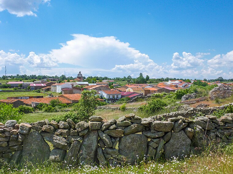
Photo: Almaraduz, CC BY-SA 4.0.
La Vídola is a municipality located in the province of Salamanca, Castile and León, Spain. As of 2016 the municipality has a population of 117 inhabitants. La Vídola is situated 4½ km northwest of Camino de las Uces Real.
Camino de las Uces Real
- Type: Locality
- Location: Villar de Samaniego, Salamanca, Castile and León, Central Spain, Spain, Iberia, Europe
- View on OpenStreetMap
Latitude
41.11915° or 41° 7′ 9″ northLongitude
-6.45978° or 6° 27′ 35″ westOpen location code
8CHM4G9R+M3OpenStreetMap ID
node 1241737320OpenStreetMap feature
place=locality
This page is based on OpenStreetMap, Wikidata, and Wikimedia Commons.
We’d love your help improving our open data sources. Thank you for contributing.
Satellite Map
Discover Camino de las Uces Real from above in high-definition satellite imagery.
Localities in the Area
Explore places such as Vallehuerto and Las Terrocillas.
Notable Places Nearby
Highlights include Iglesia de Nuestra Señora del Rosario and Iglesia Madre de Dios.
Castile and León: Must-Visit Destinations
Delve into Valladolid, Salamanca, Segovia, and León.
Curious Localities to Discover
Uncover intriguing localities from every corner of the globe.
About Mapcarta. Data © OpenStreetMap contributors and available under the Open Database License". Text is available under the CC BY-SA 4.0 license, except for photos, directions, and the map. Photo: Xemenendura, CC BY-SA 4.0.