Las Miguelinas
Las Miguelinas is a locality in Pozuelo de Tábara, Zamora, Castile and León. Las Miguelinas is situated nearby to the locality Cantarranas, as well as near Valdeperdices.| Tap on a place to explore it |
Places in the Area
Nearby places include Pozuelo de Tábara and Moreruela de Tábara.
Pozuelo de Tábara
Village

Photo: Hipersyl, CC BY-SA 4.0.
Pozuelo de Tábara is a municipality located in the province of Zamora, Castile and León, Spain. According to the 2004 census, the municipality has a population of 213 inhabitants. Although it may have changed by now. Pozuelo de Tábara is situated 2½ km northwest of Las Miguelinas.
Moreruela de Tábara
Village
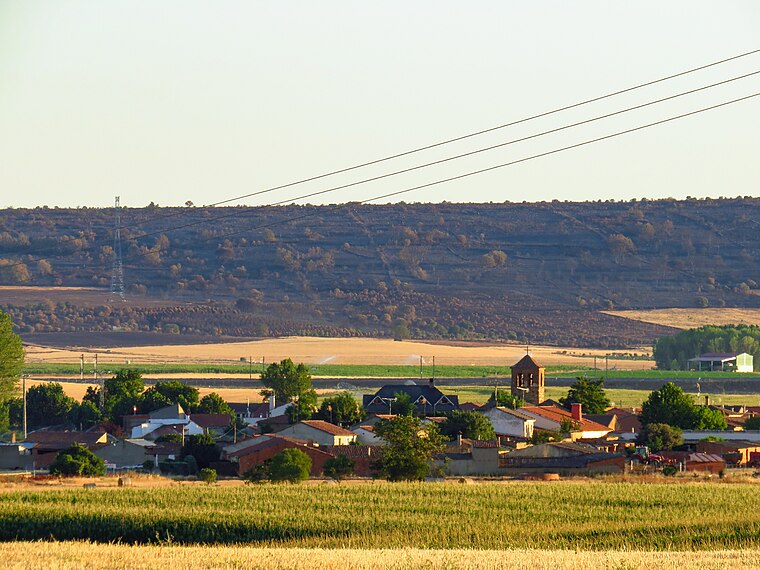
Photo: Balles2601, CC BY-SA 4.0.
Moreruela de Tábara is a municipality located in the province of Zamora, Castile and León, Spain. According to the 2004 census, the municipality had a population of 482 inhabitants. Moreruela de Tábara is situated 3 km north of Las Miguelinas.
Santa Eulalia de Tábara
Hamlet

Photo: Balles2601, CC BY-SA 4.0.
Santa Eulalia de Tábara is a hamlet, which is situated 4 km north of Las Miguelinas.
Las Miguelinas
- Type: Locality
- Location: Pozuelo de Tábara, Zamora, Castile and León, Central Spain, Spain, Iberia, Europe
- View on OpenStreetMap
Latitude
41.77425° or 41° 46′ 27″ northLongitude
-5.86641° or 5° 51′ 59″ westOpen location code
8CHPQ4FM+MCOpenStreetMap ID
node 1241766232OpenStreetMap feature
place=locality
This page is based on OpenStreetMap, Wikidata, and Wikimedia Commons.
We’d love your help improving our open data sources. Thank you for contributing.
Satellite Map
Discover Las Miguelinas from above in high-definition satellite imagery.
Localities in the Area
Explore places such as Cantarranas and Valdeperdices.
Notable Places Nearby
Highlights include Parque infantil Pozuelo de Tábara and Ayuntamiento de Pozuelo de Tábara.
Castile and León: Must-Visit Destinations
Delve into Valladolid, Salamanca, Segovia, and León.
Curious Localities to Discover
Uncover intriguing localities from every corner of the globe.
About Mapcarta. Data © OpenStreetMap contributors and available under the Open Database License". Text is available under the CC BY-SA 4.0 license, except for photos, directions, and the map. Photo: Wikimedia, CC BY-SA 3.0.