Calleja Chiquita
Calleja Chiquita is a locality in Valle de Mena, Burgos, Castile and León. Calleja Chiquita is situated nearby to the locality El Soto, as well as near Los Mayos.| Tap on a place to explore it |
Places of Interest
Highlights include Ordunte reservoir and Maza del Pando.

Maza del Pando
Peak
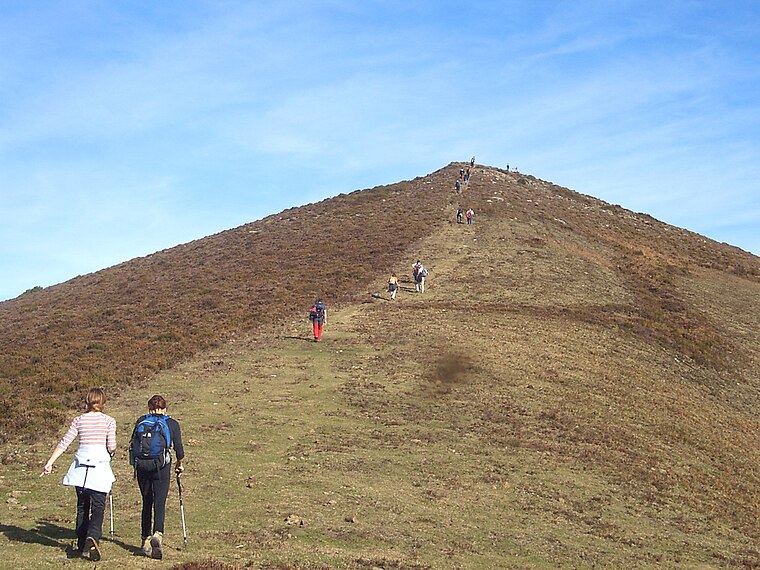
Photo: Telle, CC BY-SA 3.0.
Maza del Pando is a peak, which is situated 3½ km north of Calleja Chiquita.
Places in the Area
Nearby places include Ribota de Ordunte and Ayega de Mena.

Ayega de Mena
Hamlet

Photo: WikiBurgos, CC BY-SA 3.0.
Ayega de Mena is a hamlet, which is situated 2½ km east of Calleja Chiquita.
Nava de Ordunte
Hamlet

Photo: Etxaburu, CC BY-SA 4.0.
Nava de Ordunte is a hamlet, which is situated 4 km east of Calleja Chiquita.
Calleja Chiquita
- Type: Locality
- Location: Valle de Mena, Burgos, Castile and León, Central Spain, Spain, Iberia, Europe
- View on OpenStreetMap
Latitude
43.14475° or 43° 8′ 41″ northLongitude
-3.31811° or 3° 19′ 5″ westOpen location code
8CMR4MVJ+WQOpenStreetMap ID
node 1242408741OpenStreetMap feature
place=locality
This page is based on OpenStreetMap, Wikidata, and Wikimedia Commons.
We’d love your help improving our open data sources. Thank you for contributing.
Satellite Map
Discover Calleja Chiquita from above in high-definition satellite imagery.
Localities in the Area
Explore places such as El Soto and Los Mayos.
Notable Places Nearby
Highlights include Iglesia de Santiago Apóstol and Pozo de la Olla.
Castile and León: Must-Visit Destinations
Delve into Valladolid, Salamanca, Segovia, and León.
Curious Localities to Discover
Uncover intriguing localities from every corner of the globe.
About Mapcarta. Data © OpenStreetMap contributors and available under the Open Database License". Text is available under the CC BY-SA 4.0 license, except for photos, directions, and the map. Photo: Choniron, CC BY-SA 3.0 es.