Bajada de la Estación
Bajada de la Estación is a locality in Barrios de Colina, Burgos, Castile and León. Bajada de la Estación is situated nearby to the locality Mojabraga, as well as near Valdeladrones.| Tap on a place to explore it |
Places of Interest
Highlights include Hiniestra.

Places in the Area
Nearby places include Barrios de Colina and Fresno de Rodilla.
Barrios de Colina
Village

Photo: Davidh820, CC BY-SA 3.0 es.
Barrios de Colina is a municipality and town located in the province of Burgos, Castile and León, Spain. According to the 2004 census, the municipality has a population of 76 inhabitants.
Fresno de Rodilla
Village
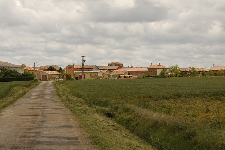
Photo: Wikimedia, CC BY-SA 3.0.
Fresno de Rodilla is a municipality located in the province of Burgos, Castile and León, Spain. According to the 2004 census, the municipality has a population of 46 inhabitants. Fresno de Rodilla is situated 2½ km northwest of Bajada de la Estación.
Piedrahita de Juarros
Hamlet

Photo: LBM1948, CC BY-SA 4.0.
Piedrahita de Juarros is a hamlet, which is situated 3 km northeast of Bajada de la Estación.
Bajada de la Estación
- Type: Locality
- Location: Barrios de Colina, Burgos, Castile and León, Central Spain, Spain, Iberia, Europe
- View on OpenStreetMap
Latitude
42.40837° or 42° 24′ 30″ northLongitude
-3.45907° or 3° 27′ 33″ westOpen location code
8CJRCG5R+89OpenStreetMap ID
node 1242434794OpenStreetMap feature
place=locality
This page is based on OpenStreetMap, Wikidata, and Wikimedia Commons.
We’d love your help improving our open data sources. Thank you for contributing.
Satellite Map
Discover Bajada de la Estación from above in high-definition satellite imagery.
Localities in the Area
Explore places such as Mojabraga and Valdeladrones.
Notable Places Nearby
Highlights include Iglesia and Ayuntamiento de Barrios de Colina.
Castile and León: Must-Visit Destinations
Delve into Valladolid, Salamanca, Segovia, and León.
Curious Localities to Discover
Uncover intriguing localities from every corner of the globe.
About Mapcarta. Data © OpenStreetMap contributors and available under the Open Database License". Text is available under the CC BY-SA 4.0 license, except for photos, directions, and the map. Photo: Choniron, CC BY-SA 3.0 es.