Cota de Pando
Cota de Pando is a locality in Oviedo, Asturias. Cota de Pando is situated nearby to the neighborhood Tocote, as well as near Villamaxil.| Tap on a place to explore it |
Places of Interest
Highlights include La Foncalada and Oviedo Cathedral.
La Foncalada
Archaeological site
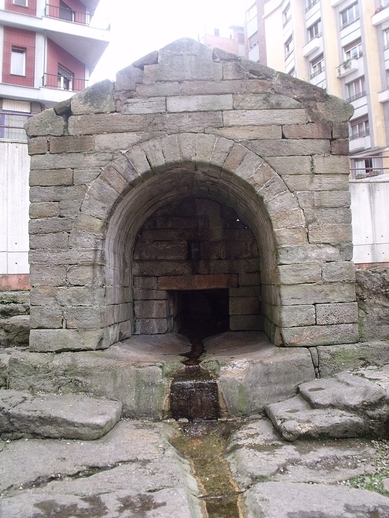
Photo: 19Tarrestnom65, CC BY-SA 4.0.
The Foncalada is a fountain of potable water located outside the city walls of Oviedo, Asturias, Spain; it was built by king Alfonso III of Asturias in the 9th century.
Oviedo Cathedral
Church
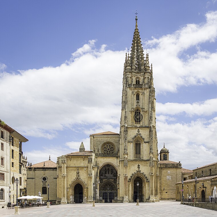
Photo: Fernando, CC BY-SA 4.0.
The Metropolitan Cathedral Basilica of the Holy Saviour or Cathedral of San Salvador is a Roman Catholic church and minor basilica in the centre of Oviedo, in the Asturias region of northern Spain.

Places in the Area
Nearby places include Buenavista and La Covadonga.

La Covadonga
Hamlet

Photo: Omarete, CC BY-SA 4.0.
La Covadonga is a hamlet, which is situated 3½ km southeast of Cota de Pando.
El Bosque
Hamlet

Photo: Omarete, CC BY-SA 4.0.
El Bosque is a hamlet, which is situated 3½ km south of Cota de Pando.
Cota de Pando
- Type: Locality
- Location: Oviedo, Asturias, Green Spain, Spain, Iberia, Europe
- View on OpenStreetMap
Latitude
43.37444° or 43° 22′ 28″ northLongitude
-5.84354° or 5° 50′ 37″ westOpen location code
8CMP95F4+QHOpenStreetMap ID
node 1242837617OpenStreetMap feature
place=locality
This page is based on OpenStreetMap, Wikidata, and Wikimedia Commons.
We’d love your help improving our open data sources. Thank you for contributing.
Satellite Map
Discover Cota de Pando from above in high-definition satellite imagery.
Localities in the Area
Explore places such as Pando and Tocote.
Notable Places Nearby
Highlights include Parque Esiderio Rodríguez Fdez. and Campo de Fútbol 7 del Fundoma.
Asturias: Must-Visit Destinations
Delve into Gijón, Aviles, Villaviciosa, and Grado.
Curious Localities to Discover
Uncover intriguing localities from every corner of the globe.
About Mapcarta. Data © OpenStreetMap contributors and available under the Open Database License". Text is available under the CC BY-SA 4.0 license, except for photos, directions, and the map. Photo: Wikimedia, CC0.