Canto Pardo
Canto Pardo is a locality in Muñopedro, Segovia, Castile and León. Canto Pardo is situated nearby to the locality Los Blases, as well as near La Cholla.| Tap on a place to explore it |
Places in the Area
Nearby places include Villacastín and Ituero y Lama.
Villacastín
Village
 Villacastín is a municipality located in the province of Segovia, Castile and León, Spain. According to the 2004 census, the municipality has a population of 1,572 inhabitants. Villacastín is situated 6 km south of Canto Pardo.
Ituero y Lama
Village
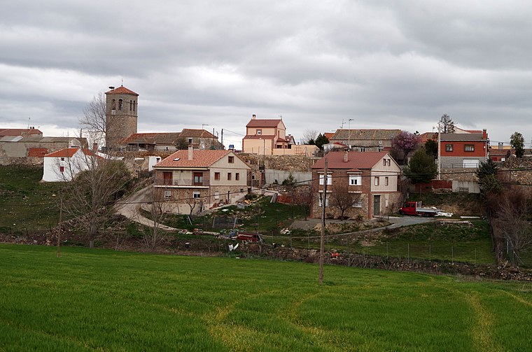
Photo: David Perez, CC BY 4.0.
Ituero y Lama is a municipality located in the province of Segovia, Castile and León, Spain. According to the 2018 census, the municipality has a population of 365. Ituero y Lama is situated 6 km southeast of Canto Pardo.
Maello
Village

Photo: David Perez, CC BY 4.0.
Maello is a municipality located in the province of Ávila, Castile and León, Spain. According to the 2004 census, the municipality has a population of 672 inhabitants. Maello is situated 7 km west of Canto Pardo.
Canto Pardo
- Type: Locality
- Location: Muñopedro, Segovia, Castile and León, Central Spain, Spain, Iberia, Europe
- View on OpenStreetMap
Latitude
40.82864° or 40° 49′ 43″ northLongitude
-4.4345° or 4° 26′ 4″ westOpen location code
8CGQRHH8+F6OpenStreetMap ID
node 1243029321OpenStreetMap feature
place=locality
This page is based on OpenStreetMap, Wikidata, and Wikimedia Commons.
We’d love your help improving our open data sources. Thank you for contributing.
Satellite Map
Discover Canto Pardo from above in high-definition satellite imagery.
Places with the Same Name
Discover other places named “Canto Pardo”.
Localities in the Area
Explore places such as Los Blases and La Cholla.
Notable Places Nearby
Highlights include Ermita de San Andrés and Lago del Pinar.
Castile and León: Must-Visit Destinations
Delve into Valladolid, Salamanca, Segovia, and León.
Curious Localities to Discover
Uncover intriguing localities from every corner of the globe.
About Mapcarta. Data © OpenStreetMap contributors and available under the Open Database License". Text is available under the CC BY-SA 4.0 license, except for photos, directions, and the map. Photo: Atention, CC BY-SA 3.0 es.