Ceja de Peña Betaya
Ceja de Peña Betaya is a locality in Cuenca, Castile-La Mancha. Ceja de Peña Betaya is situated nearby to the locality Las Melquizas, as well as near Solana de la Peguera.| Tap on a place to explore it |
Places of Interest
Highlights include Pantano de La Toba.
Places in the Area
Nearby places include Uña and Beamud.
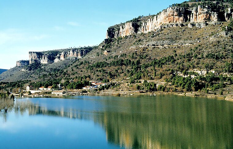
Uña
Village
 Uña is a municipality located in the province of Cuenca, Castile-La Mancha, Spain. According to the 2004 census, the municipality has a population of 138 inhabitants. Uña is situated 6 km west of Ceja de Peña Betaya.
Beamud
Village

Photo: 19Tarrestnom65, CC BY-SA 4.0.
Beamud is a municipality located in the province of Cuenca, Castile-La Mancha, Spain. It has a population of 48. Beamud is situated 7 km southeast of Ceja de Peña Betaya.
Ceja de Peña Betaya
- Type: Locality
- Location: Cuenca, Cuenca, Castile-La Mancha, Central Spain, Spain, Iberia, Europe
- View on OpenStreetMap
Latitude
40.21406° or 40° 12′ 51″ northLongitude
-1.90336° or 1° 54′ 12″ westOpen location code
8CGW637W+JMOpenStreetMap ID
node 1243078802OpenStreetMap feature
place=locality
This page is based on OpenStreetMap, Wikidata, and Wikimedia Commons.
We’d love your help improving our open data sources. Thank you for contributing.
Satellite Map
Discover Ceja de Peña Betaya from above in high-definition satellite imagery.
Localities in the Area
Explore places such as Las Melquizas and Solana de la Peguera.
Notable Places Nearby
Highlights include Cerro de Pedro Domingo and Sima de la Crin.
Castile-La Mancha: Must-Visit Destinations
Delve into Toledo, Albacete, Ciudad Real, and Consuegra.
Curious Localities to Discover
Uncover intriguing localities from every corner of the globe.
About Mapcarta. Data © OpenStreetMap contributors and available under the Open Database License". Text is available under the CC BY-SA 4.0 license, except for photos, directions, and the map. Photo: flashcurd, CC BY 2.0.