Calares de Fuencaliente
Calares de Fuencaliente is a locality in Uña, Cuenca, Castile-La Mancha. Calares de Fuencaliente is situated nearby to the locality El Torilejo, as well as near Huelga del Escobar.| Tap on a place to explore it |
Places of Interest
Highlights include Pantano de La Toba and Laguna de Uña.
Pantano de La Toba
Reservoir
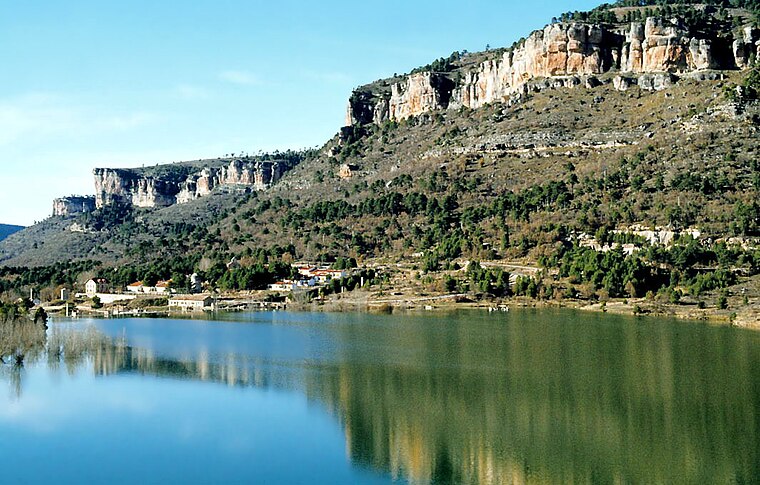
Photo: LBM1948, CC BY-SA 4.0.
Pantano de La Toba is a reservoir, which is situated 3½ km east of Calares de Fuencaliente.
Laguna de Uña

Photo: diego cue, CC BY-SA 3.0.
Laguna de Uña is situated 4 km northwest of Calares de Fuencaliente.
Places in the Area
Nearby places include Buenache de la Sierra and Valdecabras.
Buenache de la Sierra
Village

Photo: B25es, CC BY-SA 4.0.
Buenache de la Sierra is a municipality in the province of Cuenca, Castile-La Mancha, Spain. As of 2010, it has a population of 111. Buenache de la Sierra is situated 9 km southwest of Calares de Fuencaliente.
Valdecabras
Hamlet

Photo: Valdecabras, CC BY-SA 3.0.
Valdecabras is a hamlet, which is situated 10 km southwest of Calares de Fuencaliente.
Beamud
Village

Photo: 19Tarrestnom65, CC BY-SA 4.0.
Beamud is a municipality located in the province of Cuenca, Castile-La Mancha, Spain. It has a population of 48. Beamud is situated 10 km east of Calares de Fuencaliente.
Calares de Fuencaliente
- Type: Locality
- Location: Uña, Cuenca, Castile-La Mancha, Central Spain, Spain, Iberia, Europe
- View on OpenStreetMap
Latitude
40.20447° or 40° 12′ 16″ northLongitude
-1.94077° or 1° 56′ 27″ westOpen location code
8CGW6335+QMOpenStreetMap ID
node 1243168102OpenStreetMap feature
place=locality
This page is based on OpenStreetMap, Wikidata, and Wikimedia Commons.
We’d love your help improving our open data sources. Thank you for contributing.
Satellite Map
Discover Calares de Fuencaliente from above in high-definition satellite imagery.
Localities in the Area
Explore places such as El Torilejo and Huelga del Escobar.
Notable Places Nearby
Highlights include Fuente del Buitre and Cabeza Modorra.
Castile-La Mancha: Must-Visit Destinations
Delve into Toledo, Albacete, Cuenca, and Ciudad Real.
Curious Localities to Discover
Uncover intriguing localities from every corner of the globe.
About Mapcarta. Data © OpenStreetMap contributors and available under the Open Database License". Text is available under the CC BY-SA 4.0 license, except for photos, directions, and the map. Photo: flashcurd, CC BY 2.0.