Dehesa de Ahín
Dehesa de Ahín is a locality in Toledo, Castile-La Mancha. Dehesa de Ahín is situated nearby to the locality La Vega, as well as near Vega del Pilar.| Tap on a place to explore it |
Places in the Area
Nearby places include Mocejón and Algodor.
Mocejón
Village

Photo: Malopez 21, CC BY-SA 4.0.
Mocejón is a municipality located in the province of Toledo, Castile-La Mancha, Spain. According to the 2006 census, the municipality has a population of 4,963 inhabitants. Mocejón is situated 3½ km north of Dehesa de Ahín.
Algodor
Hamlet
Algodor is a small settlement between Toledo and Aranjuez, Spain. The locality is within the municipal limits of Aranjuez and is in the Community of Madrid. Algodor is situated 4½ km east of Dehesa de Ahín.
Magán
Village
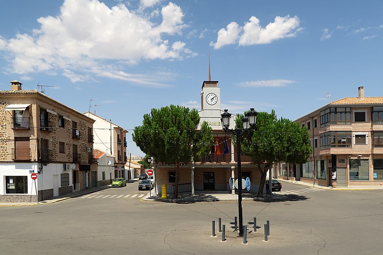
Photo: Malopez 21, CC BY-SA 4.0.
Magán is a municipality located in the province of Toledo, Castilla–La Mancha, Spain. As of 1 January 2023, the municipality has a registered population of 4,038. It has a total area of 29.24 km2. Magán is situated 6 km north of Dehesa de Ahín.
Dehesa de Ahín
- Type: Locality
- Location: Toledo, Toledo, Castile-La Mancha, Central Spain, Spain, Iberia, Europe
- View on OpenStreetMap
Latitude
39.90548° or 39° 54′ 20″ northLongitude
-3.91246° or 3° 54′ 45″ westOpen location code
8CFRW34Q+52OpenStreetMap ID
node 1243277100OpenStreetMap feature
place=locality
This page is based on OpenStreetMap, Wikidata, and Wikimedia Commons.
We’d love your help improving our open data sources. Thank you for contributing.
Satellite Map
Discover Dehesa de Ahín from above in high-definition satellite imagery.
Places with the Same Name
Discover other places named “Dehesa de Ahín”.
Localities in the Area
Explore places such as La Vega and Vega del Pilar.
Notable Places Nearby
Highlights include Pista principal and Hípica de Toledo.
Castile-La Mancha: Must-Visit Destinations
Delve into Albacete, Cuenca, Ciudad Real, and Consuegra.
Curious Localities to Discover
Uncover intriguing localities from every corner of the globe.
About Mapcarta. Data © OpenStreetMap contributors and available under the Open Database License". Text is available under the CC BY-SA 4.0 license, except for photos, directions, and the map. Photo: Diliff, CC BY-SA 3.0.