Cerro del Cofre
Cerro del Cofre is a locality in Las Rozas, Madrid, Community of Madrid. Cerro del Cofre is situated nearby to the locality El Bosquillón, as well as near El Chivitín.| Tap on a place to explore it |
Places of Interest
Highlights include Las Matas train station and La Ciudad del Fútbol.
Las Matas train station
Railway station

Photo: Wikimedia, CC BY-SA 3.0.
Las Matas train station is a railway station, which is situated 2½ km northwest of Cerro del Cofre.
La Ciudad del Fútbol
Sports venue
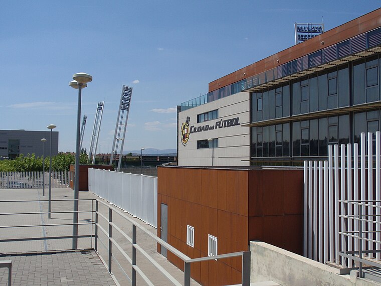
Photo: Badefa, CC BY-SA 3.0.
La Ciudad del Fútbol de la Real Federación Española de Fútbol is a football training facility opened in 2003, serving as the headquarters of the Royal Spanish Football Federation as well as the official training centre of the Spanish football team. La Ciudad del Fútbol is situated 3 km southwest of Cerro del Cofre.
Dehesa de Navalcarbón
Park

Photo: Sabbut, CC BY-SA 4.0.
Dehesa de Navalcarbón is a park, which is situated 3½ km southwest of Cerro del Cofre.
Places in the Area
Nearby places include Los Peñascales and Majadahonda.
Los Peñascales
Suburb

Photo: Esetena, CC BY-SA 3.0.
Los Peñascales is a suburb, which is situated 4½ km northwest of Cerro del Cofre.
Majadahonda
Town

Photo: Allan Patrick, CC BY-SA 2.0.
Majadahonda is a municipality in Spain, situated 16 km northwest of Madrid, in the Community of Madrid. It lies alongside the motorway A6 Madrid-A Coruña. Majadahonda is situated 7 km south of Cerro del Cofre.
Monte de El Pardo
Locality

Photo: Miguel303xm, CC BY-SA 2.5.
The Monte de El Pardo is a large forested area in Madrid, Spain, extending roughly across one quarter of the total municipal area. The Monte de El Pardo has an area of 15289.12 ha. Monte de El Pardo is situated 7 km northeast of Cerro del Cofre.
Cerro del Cofre
- Type: Locality
- Location: Las Rozas, Madrid, Community of Madrid, Central Spain, Spain, Iberia, Europe
- View on OpenStreetMap
Latitude
40.53677° or 40° 32′ 12″ northLongitude
-3.87156° or 3° 52′ 18″ westOpen location code
8CGRG4PH+P9OpenStreetMap ID
node 1243352481OpenStreetMap feature
place=locality
This page is based on OpenStreetMap, Wikidata, and Wikimedia Commons.
We’d love your help improving our open data sources. Thank you for contributing.
Satellite Map
Discover Cerro del Cofre from above in high-definition satellite imagery.
Places with the Same Name
Discover other places named “Cerro del Cofre”.
Localities in the Area
Explore places such as El Bosquillón and El Chivitín.
Notable Places Nearby
Highlights include Plaza de toros and Instituto de Magnetismo Aplicado Salvador Velayos (UCM).
Community of Madrid: Must-Visit Destinations
Delve into Madrid, Alcalá de Henares, Getafe, and Aranjuez.
Curious Localities to Discover
Uncover intriguing localities from every corner of the globe.
About Mapcarta. Data © OpenStreetMap contributors and available under the Open Database License". Text is available under the CC BY-SA 4.0 license, except for photos, directions, and the map. Photo: Wikimedia, CC0.