Cerro de Corta Encina
Cerro de Corta Encina is a locality in San Martín de Valdeiglesias, Madrid, Community of Madrid. Cerro de Corta Encina is situated nearby to the locality Cerro del Jaralón, as well as near Dehesa del Rincón.| Tap on a place to explore it |
Places of Interest
Highlights include Picadas Reservoir and Monastery of Pelayos.
Picadas Reservoir
Reservoir
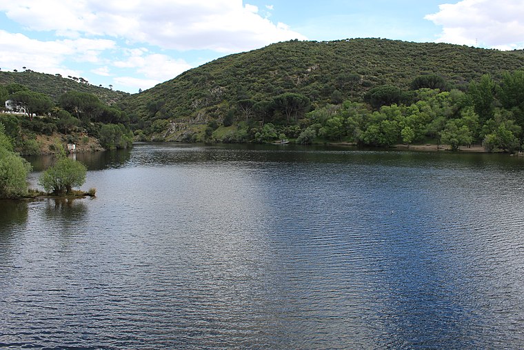
Photo: Asqueladd, CC BY-SA 4.0.
Picadas Reservoir is situated 3 km northeast of Cerro de Corta Encina.
Monastery of Pelayos
Ruins

Photo: Miguel Angel Masegosa Martínez, CC BY 2.0.
The Monastery of Pelayos is a Cistercian monastery in a state of ruin located in Pelayos de la Presa, Community of Madrid. Monastery of Pelayos is situated 4 km northwest of Cerro de Corta Encina.
Places in the Area
Nearby places include Pelayos de la Presa and Villa del Prado.
Pelayos de la Presa
Village

Photo: velomartinez, CC BY-SA 3.0.
Pelayos de la Presa is a municipality in the Community of Madrid, Spain. It covers an area of 7.58 km2. As of 2018, it has a population of 2,475. It is located in the southwest of the region, near the San Juan Reservoir, the source the municipal water supplies come from. Pelayos de la Presa is situated 4 km northwest of Cerro de Corta Encina.
Villa del Prado
Village

Photo: Wikimedia, CC BY-SA 3.0.
Villa del Prado is a municipality of the Community of Madrid, Spain. In 2022 it had a population of 7092. Sights include the church of Santiago Apóstol. Villa del Prado is situated 6 km south of Cerro de Corta Encina.
Navas del Rey
Village

Photo: Asqueladd, CC BY-SA 3.0.
Navas del Rey is a municipality of the Community of Madrid, Spain. It is located 52 kilometers from the city of Madrid, which is accessed by the road M-501. Navas del Rey is situated 7 km northeast of Cerro de Corta Encina.
Cerro de Corta Encina
- Type: Locality
- Location: San Martín de Valdeiglesias, Madrid, Community of Madrid, Central Spain, Spain, Iberia, Europe
- View on OpenStreetMap
Latitude
40.33429° or 40° 20′ 3″ northLongitude
-4.30449° or 4° 18′ 16″ westOpen location code
8CGQ8MMW+P6OpenStreetMap ID
node 1243366372OpenStreetMap feature
place=locality
This page is based on OpenStreetMap, Wikidata, and Wikimedia Commons.
We’d love your help improving our open data sources. Thank you for contributing.
Satellite Map
Discover Cerro de Corta Encina from above in high-definition satellite imagery.
Localities in the Area
Explore places such as Cerro del Jaralón and Dehesa del Rincón.
Notable Places Nearby
Highlights include Cerro del Pajar del Fraile and Cerro Rojo.
Community of Madrid: Must-Visit Destinations
Delve into Madrid, Alcalá de Henares, Getafe, and Aranjuez.
Curious Localities to Discover
Uncover intriguing localities from every corner of the globe.
About Mapcarta. Data © OpenStreetMap contributors and available under the Open Database License". Text is available under the CC BY-SA 4.0 license, except for photos, directions, and the map. Photo: Wikimedia, CC0.