El Frenillo
El Frenillo is a locality in San Martín de la Vega, Madrid, Community of Madrid. El Frenillo is situated nearby to the locality Los Cerros de Gózquez de Abajo, as well as near Buenavista.| Tap on a place to explore it |
Places of Interest
Highlights include Parque Warner Madrid and Stunt Fall.
Parque Warner Madrid
Theme park

Photo: Miguel303xm, CC BY-SA 2.5.
Parque Warner Madrid is a theme park located 23 km southeast of Madrid, Spain, in the municipality of San Martín de la Vega. The park opened as Warner Bros. Parque Warner Madrid is situated 3 km southwest of El Frenillo.
Stunt Fall
Roller coaster
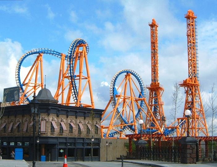
Photo: Dariogsp, CC BY-SA 4.0.
Stunt Fall is a roller coaster, which is situated 2½ km southwest of El Frenillo.
Superman: La Atracción de Acero
Roller coaster

Photo: Miguel303xm, CC BY-SA 2.5.
Superman: La Atracción de Acero is a steel floorless roller coaster at Parque Warner Madrid in Spain. Superman: La Atracción de Acero is situated 3 km south of El Frenillo.
El Frenillo
- Type: Locality
- Location: San Martín de la Vega, Madrid, Community of Madrid, Central Spain, Spain, Iberia, Europe
- View on OpenStreetMap
Latitude
40.25335° or 40° 15′ 12″ northLongitude
-3.5784° or 3° 34′ 42″ westOpen location code
8CGR7C3C+8JOpenStreetMap ID
node 1243389384OpenStreetMap feature
place=locality
This page is based on OpenStreetMap, Wikidata, and Wikimedia Commons.
We’d love your help improving our open data sources. Thank you for contributing.
Satellite Map
Discover El Frenillo from above in high-definition satellite imagery.
Places with the Same Name
Discover other places named “El Frenillo”.
Localities in the Area
Explore places such as Los Cerros de Gózquez de Abajo and Buenavista.
Notable Places Nearby
Highlights include Oso Yogui and Parque Regional del Sureste.
Community of Madrid: Must-Visit Destinations
Delve into Madrid, Alcalá de Henares, Getafe, and Aranjuez.
Curious Localities to Discover
Uncover intriguing localities from every corner of the globe.
About Mapcarta. Data © OpenStreetMap contributors and available under the Open Database License". Text is available under the CC BY-SA 4.0 license, except for photos, directions, and the map. Photo: Wikimedia, CC0.