Cerro de Valdepinillos
Cerro de Valdepinillos is a locality in Camarma de Esteruelas, Madrid, Community of Madrid. Cerro de Valdepinillos is situated nearby to the locality Los Cohechos, as well as near La Mina.| Tap on a place to explore it |
Places of Interest
Highlights include Church of Nuestra Señora de la Asunción.
Church of Nuestra Señora de la Asunción
Church
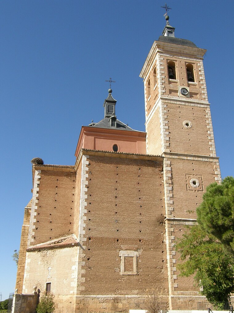
Photo: EventusBonus, CC BY-SA 3.0.
The Church of Nuestra Señora de la Asunción is a church and parish in Meco, Spain. The church was added to the Bien de Interés Cultural registry in 1982. Church of Nuestra Señora de la Asunción is situated 4 km southeast of Cerro de Valdepinillos.
Places in the Area
Nearby places include Meco and Fresno de Torote.
Meco
Town

Photo: Rastrojo, CC BY-SA 4.0.
Meco is a municipality in the eastern part of the Autonomous Community of Madrid. In 2006, Meco had a population of 11,094. The town is located to the north of the River Henares, in the comarca of La Campiña del Henares, and also in one of the two natural sub-comarcas that make up the Comarca de Alcalá, La Campiña del Henares, characterized by vast grain fields and gentle hills. Meco is situated 4 km southeast of Cerro de Valdepinillos.
Fresno de Torote
Village

Photo: Wikimedia, CC BY 3.0 es.
Fresno de Torote is a municipality of the autonomous community of Madrid in central Spain. It belongs to the comarca of Alcalá. Sights include the church of San Esteban, in Mudéjar-Renaissance style. Fresno de Torote is situated 4½ km northwest of Cerro de Valdepinillos.
Valdeavero
Village

Photo: Valle de Aves, CC BY 4.0.
Valdeavero is a municipality of the Community of Madrid, Spain. Valdeavero is situated 7 km northeast of Cerro de Valdepinillos.
Cerro de Valdepinillos
- Type: Locality
- Location: Camarma de Esteruelas, Madrid, Community of Madrid, Central Spain, Spain, Iberia, Europe
- View on OpenStreetMap
Latitude
40.57665° or 40° 34′ 36″ northLongitude
-3.36399° or 3° 21′ 50″ westOpen location code
8CGRHJGP+MCOpenStreetMap ID
node 1243398544OpenStreetMap feature
place=locality
This page is based on OpenStreetMap, Wikidata, and Wikimedia Commons.
We’d love your help improving our open data sources. Thank you for contributing.
Satellite Map
Discover Cerro de Valdepinillos from above in high-definition satellite imagery.
Localities in the Area
Explore places such as Los Cohechos and La Mina.
Notable Places Nearby
Highlights include Parque Víctimas del 11-M and Oficina de Correos.
Community of Madrid: Must-Visit Destinations
Delve into Madrid, Alcalá de Henares, Getafe, and Aranjuez.
Curious Localities to Discover
Uncover intriguing localities from every corner of the globe.
About Mapcarta. Data © OpenStreetMap contributors and available under the Open Database License". Text is available under the CC BY-SA 4.0 license, except for photos, directions, and the map. Photo: Wikimedia, CC0.