Pla de la Perola
Pla de la Perola is a locality in Alzira, Valencia, Valencian Community. Pla de la Perola is situated nearby to the locality la Muntanya, as well as near Les Llomes.| Tap on a place to explore it |
Places in the Area
Nearby places include Tous Municipality and Benimodo Municipality.
Tous Municipality
Village

Photo: Javigar, CC BY-SA 4.0.
Tous is a municipality in the Valencian Community, in the province of Valencia. The town is notable for the dam failure which occurred on 20 October 1982, when an unusually severe rainfall swelled the river Jucar, breaking the Tous Dam. Tous Municipality is situated 5 km south of Pla de la Perola.
Benimodo Municipality
Village

Photo: 19Tarrestnom65, CC BY-SA 4.0.
Benimodo is a municipality in the comarca of Ribera Alta in the Valencian Community, Spain. Benimodo Municipality is situated 5 km northeast of Pla de la Perola.
L’Alcúdia
Town
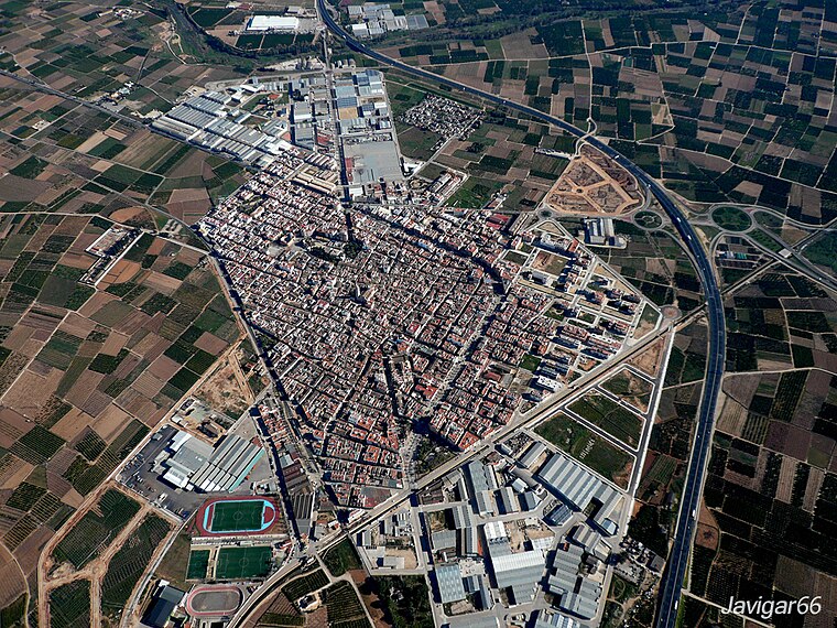
Photo: Javigar, CC BY-SA 4.0.
L'Alcúdia is a town and municipality in the province of Valencia, Spain. It is located on the left bank of the river Xúquer. L’Alcúdia is situated 6 km east of Pla de la Perola.
Pla de la Perola
- Type: Locality
- Location: Alzira, Valencia, Valencian Community, Eastern Spain, Spain, Iberia, Europe
- View on OpenStreetMap
Latitude
39.18575° or 39° 11′ 9″ northLongitude
-0.57847° or 0° 34′ 43″ westOpen location code
8CFX5CPC+7JOpenStreetMap ID
node 1243422769OpenStreetMap feature
place=locality
This page is based on OpenStreetMap, Wikidata, and Wikimedia Commons.
We’d love your help improving our open data sources. Thank you for contributing.
Satellite Map
Discover Pla de la Perola from above in high-definition satellite imagery.
In Other Languages
“Pla de la Perola” goes by many names.
- Catalan: “Pla de la Perola”
Localities in the Area
Explore places such as la Muntanya and Les Llomes.
Notable Places Nearby
Highlights include Coves del Truig and Font de la Garrofera.
Valencia: Must-Visit Destinations
Delve into Valencia, Sagunto, Gandía, and Xàtiva.
Curious Localities to Discover
Uncover intriguing localities from every corner of the globe.
About Mapcarta. Data © OpenStreetMap contributors and available under the Open Database License". Text is available under the CC BY-SA 4.0 license, except for photos, directions, and the map. Photo: andruby, CC BY 2.0.