Cerro de la Covatilla
Cerro de la Covatilla is a peak in Pareja, Guadalajara, Castile-La Mancha and has an elevation of 1,004 metres. Cerro de la Covatilla is situated nearby to the locality La Culebra, as well as near La Dehesa.| Tap on a place to explore it |
Places in the Area
Nearby places include Mantiel and Alique.
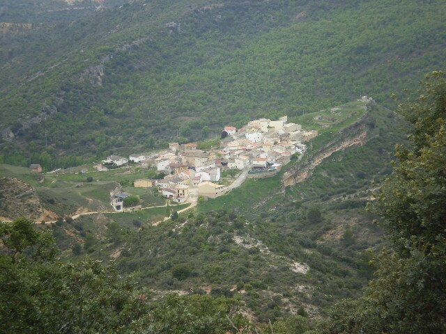
Mantiel
Village

Photo: Wikimedia, CC BY-SA 4.0.
Mantiel is a municipality located in the province of Guadalajara, Castile-La Mancha, Spain. According to the 2004 census, the municipality has a population of 79 inhabitants.
Alique
Village

Photo: Wikimedia, CC BY-SA 4.0.
Alique is a municipality located in the province of Guadalajara, Castile-La Mancha, Spain. According to the 2004 census, the municipality has a population of 36 inhabitants.
Cerro de la Covatilla
- Type: Peak with an elevation of 1,004 metres
- Category: landform
- Location: Pareja, Guadalajara, Castile-La Mancha, Central Spain, Spain, Iberia, Europe
- View on OpenStreetMap
Latitude
40.6214° or 40° 37′ 17″ northLongitude
-2.6141° or 2° 36′ 51″ westElevation
1,004 metres (3,294 feet)Open location code
8CGVJ9CP+H9OpenStreetMap ID
node 1243674191OpenStreetMap feature
natural=peak
This page is based on OpenStreetMap, Wikidata, and Wikimedia Commons.
We’d love your help improving our open data sources. Thank you for contributing.
Satellite Map
Discover Cerro de la Covatilla from above in high-definition satellite imagery.
Localities in the Area
Explore places such as La Culebra and La Dehesa.
Notable Places Nearby
Highlights include Cerro de la Nevera and Cerroillo de la Ajedrea.
Castile-La Mancha: Must-Visit Destinations
Delve into Toledo, Albacete, Cuenca, and Ciudad Real.
Curious Peaks to Discover
Uncover intriguing peaks from every corner of the globe.
About Mapcarta. Data © OpenStreetMap contributors and available under the Open Database License". Text is available under the CC BY-SA 4.0 license, except for photos, directions, and the map. Photo: Poco a poco, CC BY-SA 4.0.