Risco de Peña Rubia
Risco de Peña Rubia is a locality in Cifuentes, Guadalajara, Castile-La Mancha. Risco de Peña Rubia is situated nearby to the locality Monte Cerrada, as well as near Alto de la Hoya de la Virgen.| Tap on a place to explore it |
Places of Interest
Highlights include Trillo town hall and Santa María de Óvila.
Trillo town hall
Town hall

Photo: Oilisab, CC BY-SA 4.0.
Trillo town hall is situated 2½ km southwest of Risco de Peña Rubia.
Santa María de Óvila

Photo: Sevegi, CC BY-SA 4.0.
Santa María de Óvila is a former Cistercian monastery built in Spain beginning in 1181 on the Tagus River near Trillo, Guadalajara, about 90 miles northeast of Madrid. Santa María de Óvila is situated 3 km southeast of Risco de Peña Rubia.
Church of la Asunción, Trillo
Church

Photo: Luis Rogelio HM, CC BY-SA 2.0.
Church of la Asunción, Trillo is situated 2½ km southwest of Risco de Peña Rubia.
Places in the Area
Nearby places include Trillo and Ruguilla.
Trillo
Village

Photo: Fran Ara, CC BY-SA 4.0.
Trillo is a municipality located in the province of Guadalajara, Spain. According to the 2007 census, the municipality has a population of 1,371 inhabitants. Trillo is situated 2½ km southwest of Risco de Peña Rubia.
Ruguilla
Hamlet

Photo: Wikimedia, CC BY-SA 2.0.
Ruguilla is a hamlet, which is situated 3 km north of Risco de Peña Rubia.
Viana de Mondéjar
Hamlet
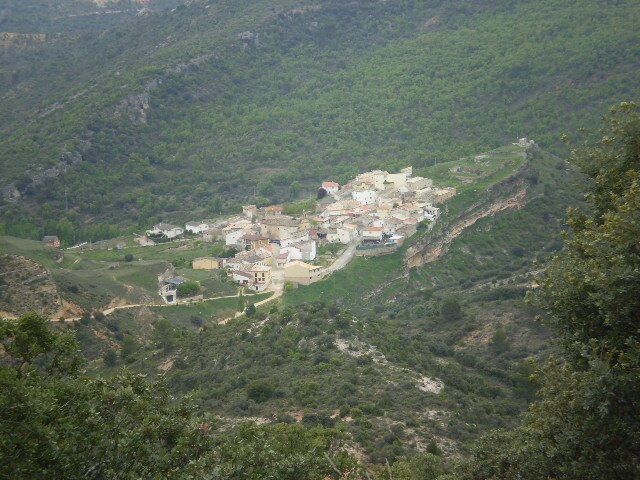
Photo: Fran Ara, CC BY-SA 4.0.
Viana de Mondéjar is a hamlet, which is situated 8 km south of Risco de Peña Rubia.
Risco de Peña Rubia
- Type: Locality
- Location: Cifuentes, Guadalajara, Castile-La Mancha, Central Spain, Spain, Iberia, Europe
- View on OpenStreetMap
Latitude
40.72201° or 40° 43′ 19″ northLongitude
-2.58007° or 2° 34′ 48″ westOpen location code
8CGVPCC9+RXOpenStreetMap ID
node 1243701979OpenStreetMap feature
place=locality
This page is based on OpenStreetMap, Wikidata, and Wikimedia Commons.
We’d love your help improving our open data sources. Thank you for contributing.
Satellite Map
Discover Risco de Peña Rubia from above in high-definition satellite imagery.
Localities in the Area
Explore places such as Alto de la Hoya de la Virgen and Monte Cerrada.
Notable Places Nearby
Highlights include Pico Cobacha and Fuente de la Señora.
Castile-La Mancha: Must-Visit Destinations
Delve into Toledo, Albacete, Cuenca, and Ciudad Real.
Curious Localities to Discover
Uncover intriguing localities from every corner of the globe.
About Mapcarta. Data © OpenStreetMap contributors and available under the Open Database License". Text is available under the CC BY-SA 4.0 license, except for photos, directions, and the map. Photo: Poco a poco, CC BY-SA 4.0.