Cerro Mediano del Monte
Cerro Mediano del Monte is a locality in Maján, Soria, Castile and León. Cerro Mediano del Monte is situated nearby to the locality Cabeza Gorda, as well as near Llano la Roza.| Tap on a place to explore it |
Places in the Area
Nearby places include Maján and Momblona.
Maján
Village

Photo: Wikimedia, CC BY-SA 4.0.
Maján is a municipality located in the province of Soria, Castile and León, Spain. According to the 2004 census, the municipality has a population of 16 inhabitants.
Momblona
Village
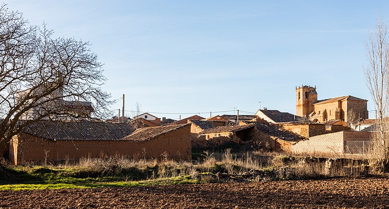
Photo: Wikimedia, CC BY-SA 4.0.
Momblona is a municipality located in the province of Soria, Castile and León, Spain. According to the 2004 census, the municipality had a population of 37 inhabitants. Momblona is situated 4½ km west of Cerro Mediano del Monte.
Velilla de los Ajos
Village

Photo: Jirafa66, CC BY-SA 3.0.
Velilla de los Ajos is a municipality located in the province of Soria, Castile and León, Spain. According to the 2004 census, the municipality has a population of 41 inhabitants. Velilla de los Ajos is situated 5 km northeast of Cerro Mediano del Monte.
Cerro Mediano del Monte
- Type: Locality
- Location: Maján, Soria, Castile and León, Central Spain, Spain, Iberia, Europe
- View on OpenStreetMap
Latitude
41.45937° or 41° 27′ 34″ northLongitude
-2.29463° or 2° 17′ 41″ westOpen location code
8CHVFP54+P4OpenStreetMap ID
node 1243761372OpenStreetMap feature
place=locality
This page is based on OpenStreetMap, Wikidata, and Wikimedia Commons.
We’d love your help improving our open data sources. Thank you for contributing.
Satellite Map
Discover Cerro Mediano del Monte from above in high-definition satellite imagery.
Localities in the Area
Explore places such as Cabeza Gorda and Llano la Roza.
Notable Places Nearby
Highlights include Ermita de San Millán and Ayuntamiento de Velilla de los Ajos.
Castile and León: Must-Visit Destinations
Delve into Valladolid, Salamanca, Segovia, and León.
Curious Localities to Discover
Uncover intriguing localities from every corner of the globe.
About Mapcarta. Data © OpenStreetMap contributors and available under the Open Database License". Text is available under the CC BY-SA 4.0 license, except for photos, directions, and the map. Photo: Wikimedia, CC BY-SA 3.0.