Brynteg Chapel Gorseinon Substation
Brynteg Chapel Gorseinon Substation is an electrical substation in Gorseinon, Swansea, Wales. Brynteg Chapel Gorseinon Substation is situated nearby to the church Eglwys Annibyniol Brynteg, as well as near Penyrheol Primary School.| Tap on a place to explore it |
Places of Interest Nearby
Highlights include Gorseinon Hospital and Penyrheol Comprehensive School.
Gorseinon Hospital
Hospital

Photo: Jaggery, CC BY-SA 2.0.
Gorseinon Hospital is a rehabilitation hospital in Gorseinon, Wales. It is managed by Swansea Bay University Health Board. Gorseinon Hospital is situated 850 feet southwest of Brynteg Chapel Gorseinon Substation.
Penyrheol Comprehensive School
School
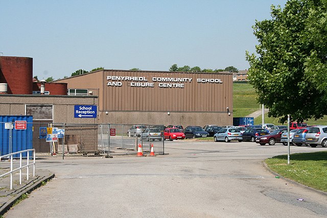
Photo: Martin Bodman, CC BY-SA 2.0.
Penyrheol Comprehensive School is a secondary school in Gorseinon, Swansea, Wales. Penyrheol Comprehensive School is situated 860 feet east of Brynteg Chapel Gorseinon Substation.
Tabernacle English Calvinistic Methodist Church
Church

Photo: Jaggery, CC BY-SA 2.0.
Tabernacle English Calvinistic Methodist Church is situated 1,600 feet south of Brynteg Chapel Gorseinon Substation.
Places in the Area
Nearby places include Penyrheol and Gorseinon.
Penyrheol
Suburb
Penyrheol is a suburban district of Swansea, Wales falling within the Penyrheol ward. Penyrheol is located about 7 miles north west of Swansea city centre in northwest Gorseinon.
Gorseinon
Town

Photo: Ruth Sharville, CC BY-SA 2.0.
Gorseinon is a town within the City and County of Swansea, Wales, near the Loughor estuary. It was a small village until the late 19th century, when it grew around the coal mining and tinplate industries.
Kingsbridge
Suburb

Photo: Jaggery, CC BY-SA 2.0.
Kingsbridge, is a village in the City and County of Swansea, Wales falling within the Kingsbridge ward. It covers the south east of the town of Gorseinon.
Brynteg Chapel Gorseinon Substation
- Type: Electrical substation
- Category: industry
- Location: Gorseinon, Swansea, Wales, United Kingdom, Britain and Ireland, Europe
- View on OpenStreetMap
Latitude
51.67387° or 51° 40′ 26″ northLongitude
-4.04537° or 4° 2′ 43″ westOpen location code
9C3QMXF3+GVOpenStreetMap ID
node 12463843263OpenStreetMap feature
man_made=street_cabinet
This page is based on OpenStreetMap, Wikidata, and Wikimedia Commons.
We’d love your help improving our open data sources. Thank you for contributing.
Satellite Map
Discover Brynteg Chapel Gorseinon Substation from above in high-definition satellite imagery.
Notable Places Nearby
Highlights include Eglwys Annibyniol Brynteg and Penyrheol Primary School.
Nearby Places
Explore places such as Gorseinon Hospital Substation and Brynteg Housing Gorseinon Substation.
Wales: Must-Visit Destinations
Delve into Cardiff, Newport, Llanfairpwllgwyngyll, and Bangor.
Curious Electrical Substations to Discover
Uncover intriguing electrical substations from every corner of the globe.
About Mapcarta. Data © OpenStreetMap contributors and available under the Open Database License". Text is available under the CC BY-SA 4.0 license, except for photos, directions, and the map. Photo: Andrew Evans, CC BY 2.0.