Jerky Jerky
Jerky Jerky is a fast food restaurant in California, United States which is located on Dolliver Street. Jerky Jerky is situated nearby to the church International Gospel League, as well as near the police station Pismo Beach Police.| Tap on a place to explore it |
Places of Interest Nearby
Highlights include Grover Beach station.
Grover Beach station
Railway station
 Grover Beach station is a passenger rail station in the city of Grover Beach, California. Grover Beach station is served by four Amtrak Pacific Surfliner trains. Grover Beach station is situated 1½ miles southeast of Jerky Jerky.
Places in the Area
Nearby places include Pismo Beach and Grover Beach.
Pismo Beach
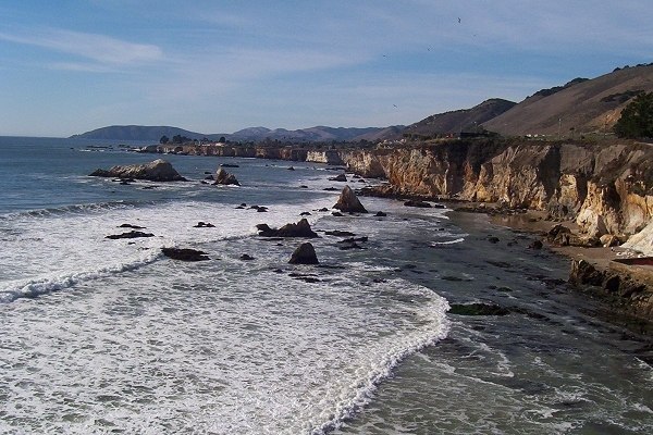
Photo: Nodq, Public domain.
Pismo Beach is in San Luis Obispo County in the Central Coast region of California. It is part of the Five Cities Metropolitan Area which also includes Shell Beach, and Grover Beach, Oceano and Arroyo Grande, all to the south and south-east of Pismo Beach.
Grover Beach
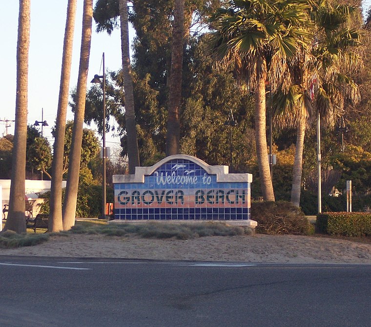 Grover Beach is in San Luis Obispo County in the Central Coast region of California. It is part of the Five Cities Metropolitan Area which also includes Oceano to the south, Arroyo Grande to the east, and Pismo Beach and Shell Beach to the north.
Oceano
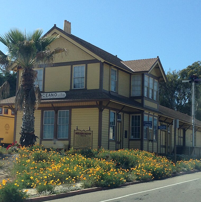
Photo: Fruitianslip, CC BY-SA 4.0.
Oceano is a city in San Luis Obispo County, California. It is part of the Five Cities Metropolitan Area which also includes Arroyo Grande to the north-east, and Grover Beach, Pismo Beach and Shell Beach to the north.
Jerky Jerky
- Type: Fast food restaurant
- Address: 702 Dolliver Street
- Categories: food and restaurant
- Location: California, United States, North America
- View on OpenStreetMap
Latitude
35.14102° or 35° 8′ 28″ northLongitude
-120.64128° or 120° 38′ 29″ westOpen location code
847X49R5+CFOpenStreetMap ID
node 12466036971OpenStreetMap feature
amenity=fast_food
This page is based on OpenStreetMap, Wikidata, and Wikimedia Commons.
We’d love your help improving our open data sources. Thank you for contributing.
Satellite Map
Discover Jerky Jerky from above in high-definition satellite imagery.
Notable Places Nearby
Highlights include Pismo Beach Police and International Gospel League.
Nearby Places
Explore places such as Pismo Market Liquor and Moreno’s Taqueria.
California: Must-Visit Destinations
Delve into San Francisco, Los Angeles, San Diego, and Sacramento.
Curious Fast Food Restaurants to Discover
Uncover intriguing fast food restaurants from every corner of the globe.
About Mapcarta. Data © OpenStreetMap contributors and available under the Open Database License". Text is available under the CC BY-SA 4.0 license, except for photos, directions, and the map. Photo: Wikimedia, CC BY-SA 2.0.