Foundry Road Substation
Foundry Road Substation is an electrical substation in Ammanford, Carmarthenshire, Wales. Foundry Road Substation is situated nearby to the recreation area Coal Town Coffee, as well as near Ammanford Police Station.| Tap on a place to explore it |
Places of Interest Nearby
Highlights include Ammanford Town Hall and Bethany Chapel.
Ammanford Town Hall
Town hall

Photo: John Lord, CC BY-SA 2.0.
Ammanford Town Hall is a municipal building located on Iscennen Street in Ammanford in Carmarthenshire in Wales. The structure is currently used as the offices and meeting place of Ammanford Town Council. Ammanford Town Hall is situated 2,100 feet northwest of Foundry Road Substation.
Bethany Chapel
Church

Photo: Marion Phillips, CC BY-SA 2.0.
Bethany was a Calvinistic Methodist/ Presbyterian Church of Wales chapel in Ammanford, Carmarthenshire, Wales, from 1881 to 2023. Services were conducted in Welsh, despite some members of the original founding committee proposing an English language chapel. Bethany Chapel is situated 1,600 feet west of Foundry Road Substation.
Ammanford railway station
Railway station
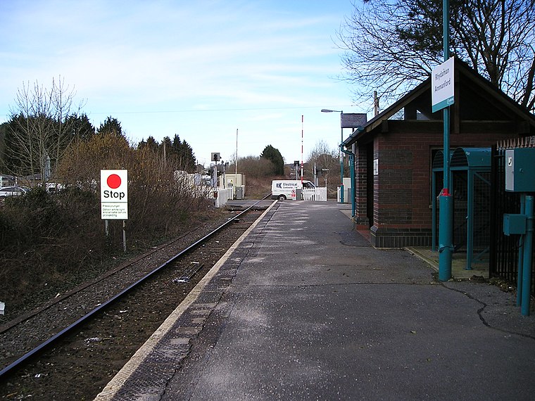
Photo: Marion Phillips, CC BY-SA 2.0.
Ammanford railway station in Ammanford, Carmarthenshire, Wales, is 12 miles north of Swansea on the Heart of Wales Line. The station opened in 1841 as a temporary terminus of the Llanelly Railway's line to Llandeilo, making it one of the country's earlier railway stations. Ammanford railway station is situated 3,300 feet northwest of Foundry Road Substation.
Places in the Area
Nearby places include Betws and Pantyffynnon.
Betws
Village
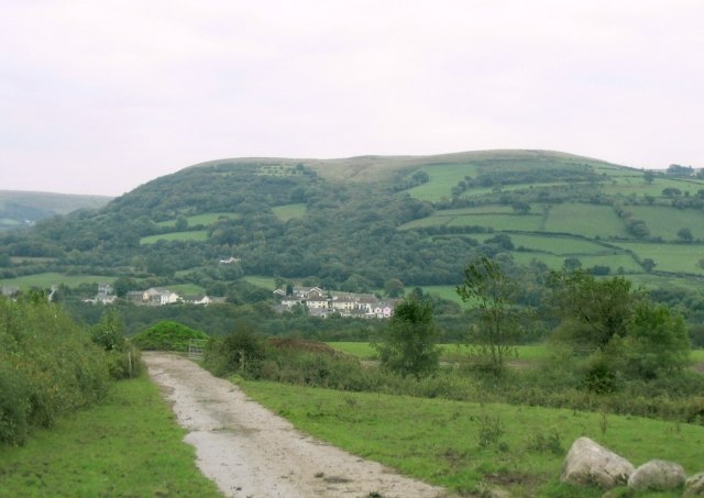
Photo: Nigel Davies, CC BY-SA 2.0.
Betws is a small village and community on the River Amman in Carmarthenshire, Wales, some 15 miles north of Swansea; it is part of the ecclesiastical parish of Betws and Ammanford, and the urban area of Ammanford.
Pantyffynnon
Village
Pantyffynnon is a small village in Carmarthenshire, Wales, half a mile south-west of Ammanford, and a mile east of Tycroes. It lies between the rivers Loughor and Amman at the foot of Mynydd y Betws.
Saron
Village

Photo: Nigel Davies, CC BY-SA 2.0.
Saron is a mining village near the town of Ammanford in Carmarthenshire, Wales. Saron is in the community of Llandybie. It is named after Saron Baptist Chapel which was established around 1810. Saron is situated 2 miles west of Foundry Road Substation.
Foundry Road Substation
- Type: Electrical substation
- Category: industry
- Location: Ammanford, Carmarthenshire, South Wales, Wales, United Kingdom, Britain and Ireland, Europe
- View on OpenStreetMap
Latitude
51.79163° or 51° 47′ 30″ northLongitude
-3.98351° or 3° 59′ 1″ westOpen location code
9C3RQ2R8+MHOpenStreetMap ID
node 12485451335OpenStreetMap feature
man_made=street_cabinet
This page is based on OpenStreetMap, Wikidata, and Wikimedia Commons.
We’d love your help improving our open data sources. Thank you for contributing.
Satellite Map
Discover Foundry Road Substation from above in high-definition satellite imagery.
Notable Places Nearby
Highlights include Coal Town Coffee and Ammanford Police Station.
Nearby Places
Explore places such as Lidl and Coaltown Coffee Roasters.
Carmarthenshire: Must-Visit Destinations
Delve into Carmarthen, Llanelli, Llandovery, and Kidwelly.
Curious Electrical Substations to Discover
Uncover intriguing electrical substations from every corner of the globe.
About Mapcarta. Data © OpenStreetMap contributors and available under the Open Database License". Text is available under the CC BY-SA 4.0 license, except for photos, directions, and the map. Photo: Wikimedia, CC0.