Sauer & Knorr
Sauer & Knorr is a medical equipment shop in Urmitz, Mayen-Koblenz, Rhineland-Palatinate. Sauer & Knorr is situated nearby to the health club Fit+, as well as near the church Kapelle.| Tap on a place to explore it |
Places of Interest Nearby
Highlights include Schloss Engers and Urmitzer Eisenbahnbrücke.
Schloss Engers
Castle

Photo: Wolkenkratzer, CC BY-SA 3.0.
Schloss Engers is a Baroque-style palace in Engers, near Koblenz, Germany. It is situated on the banks of the Rhine river. Johann IX Philipp von Walderdorff, Prince-Elector of Trier, constructed the palace between 1759 and 1764 based on a design by the architect Johanness Seiz. Schloss Engers is situated 1¼ km southeast of Sauer & Knorr.
Urmitzer Eisenbahnbrücke
Bridge

Photo: Schaengel, CC BY-SA 3.0 de.
Urmitzer Eisenbahnbrücke is a bridge, which is situated 750 metres south of Sauer & Knorr.
Engers station
Railway station

Photo: A.Savin, CC BY-SA 3.0.
Engers station is a through station and a former railway junction in the district of Engers in the town of Neuwied in the German state of Rhineland-Palatinate. Engers station is situated 1¼ km east of Sauer & Knorr.
Places in the Area
Nearby places include Engers and Kaltenengers.
Engers
Suburb

Photo: Möwe-rhein601, CC BY-SA 3.0.
Engers is a district of Neuwied on the right banks of the river Rhine in Germany located next to Koblenz in Rhineland-Palatinate. Engers has 5,367 inhabitants. It is highwater-endangered by its direct contact with the river Rhine.
Kaltenengers
Village
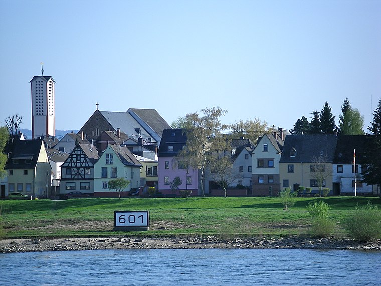
Photo: Volkes Stimme, CC BY-SA 3.0 de.
Kaltenengers is a municipality in the district of Mayen-Koblenz in Rhineland-Palatinate, western Germany.

Sauer & Knorr
- Type: Medical equipment shop
- Categories: shop and health care
- Location: Urmitz, Mayen-Koblenz, Rhineland-Palatinate, Germany, Central Europe, Europe
- View on OpenStreetMap
Latitude
50.4283° or 50° 25′ 42″ northLongitude
7.52948° or 7° 31′ 46″ eastOpen location code
9F29CGHH+8QOpenStreetMap ID
node 12531728130OpenStreetMap feature
shop=medical_supply
This page is based on OpenStreetMap, Wikidata, and Wikimedia Commons.
We’d love your help improving our open data sources. Thank you for contributing.
Satellite Map
Discover Sauer & Knorr from above in high-definition satellite imagery.
Notable Places Nearby
Highlights include Fit+ and Kapelle.
Nearby Places
Explore places such as Kanal Wambach GmbH and Bodewa.
Rhineland-Palatinate: Must-Visit Destinations
Delve into Mainz, Trier, Koblenz, and Worms.
Curious Medical Equipment Shops to Discover
Uncover intriguing medical equipment shops from every corner of the globe.
About Mapcarta. Data © OpenStreetMap contributors and available under the Open Database License". Text is available under the CC BY-SA 4.0 license, except for photos, directions, and the map. Photo: Traveler100, CC BY-SA 3.0.