Shelby’s Garden
Shelby’s Garden is an interior decorations shop in San Mateo, California. Shelby’s Garden is situated nearby to the railway station San Carlos station, as well as near the arts center Laurel Street Arts.| Tap on a place to explore it |
Places of Interest Nearby
Highlights include San Carlos station and San Carlos Airport.
San Carlos station
Railway station

Photo: Pi.1415926535, CC BY-SA 3.0.
San Carlos station is a Caltrain commuter rail station in San Carlos, California. The 1888-built station building, no longer used for railroad purposes, is listed on the National Register of Historic Places. San Carlos station is situated 540 feet north of Shelby’s Garden.
San Carlos Airport
Aerodrome

Photo: Ikluft, CC BY-SA 3.0.
San Carlos Airport is a public airfield located two miles northeast of San Carlos, California, in San Mateo County and serves the San Francisco Bay Area.
Hiller Aviation Museum
Museum

Photo: BrokenSphere, CC BY-SA 3.0.
The Hiller Aviation Museum is an aviation museum located at the San Carlos Airport in San Carlos, California, focused on Northern California aviation history, Hiller Aircraft and helicopter history. Hiller Aviation Museum is situated 3,200 feet northeast of Shelby’s Garden.
Places in the Area
Nearby places include San Carlos and Redwood Shores.
San Carlos

Photo: CityofSanCarlos, CC BY-SA 4.0.
San Carlos is on the Peninsula in the San Francisco Bay Area of California.
Redwood Shores
Hamlet

Photo: BrokenSphere, CC BY-SA 3.0.
Redwood Shores is a waterfront community in Redwood City, California, along the western shore of San Francisco Bay on the San Francisco Peninsula in San Mateo County. Redwood Shores is situated 2 miles north of Shelby’s Garden.
Belmont
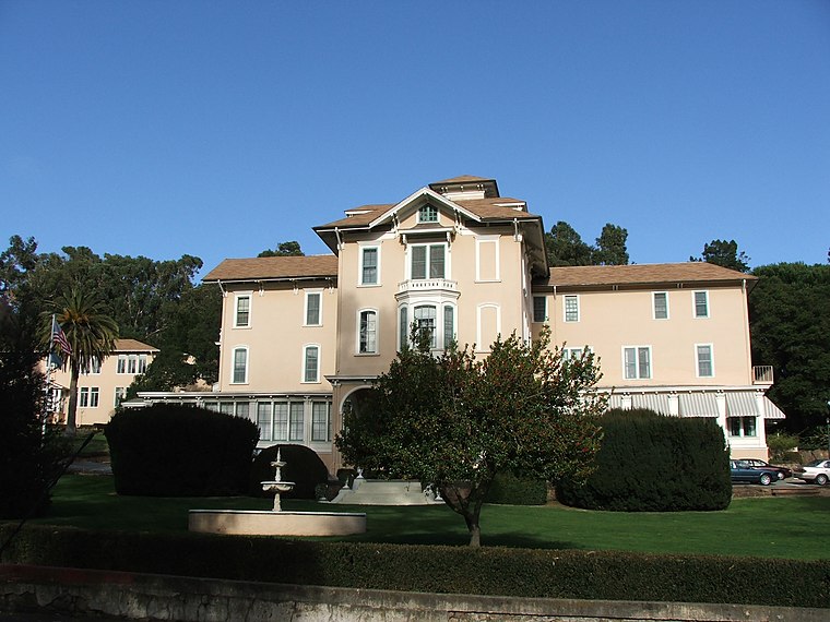
Photo: Kglavin, CC BY-SA 3.0.
Belmont is a city in San Mateo County, California, United States. It is in the San Francisco Bay Area, on the San Francisco Peninsula about halfway between San Francisco and San Jose.
Shelby’s Garden
- Type: Interior decorations shop
- Category: shop
- Location: San Mateo, California, United States, North America
- View on OpenStreetMap
Latitude
37.50612° or 37° 30′ 22″ northLongitude
-122.26036° or 122° 15′ 37″ westOpen location code
849VGP4Q+CVOpenStreetMap ID
node 12559556684OpenStreetMap feature
shop=interior_decoration
This page is based on OpenStreetMap, Wikidata, and Wikimedia Commons.
We’d love your help improving our open data sources. Thank you for contributing.
Satellite Map
Discover Shelby’s Garden from above in high-definition satellite imagery.
Notable Places Nearby
Highlights include Laurel Street Arts and Museum of San Carlos History.
Nearby Places
Explore places such as The Cabinet Center and Society.
California: Must-Visit Destinations
Delve into San Francisco, Los Angeles, San Diego, and Sacramento.
Curious Interior Decorations Shops to Discover
Uncover intriguing interior decorations shops from every corner of the globe.
About Mapcarta. Data © OpenStreetMap contributors and available under the Open Database License". Text is available under the CC BY-SA 4.0 license, except for photos, directions, and the map. Photo: Wikimedia, CC BY-SA 2.0.