Rock Steady Eddie’s
Rock Steady Eddie’s is a café in London Borough of Southwark, Greater London, England which is located on Coldharbour Lane. Rock Steady Eddie’s is situated nearby to Possibility Assembly Church, as well as near Camberwell Green Post Office.| Tap on a place to explore it |
- Opening hours:
Monday—Friday: 7:30 AM—5:00 PM
Saturday: 8:00 AM—5:00 PM
Sunday: 8:30 AM—4:00 PM - Type: Café
- Address: 2A Coldharbour Lane, London, SE5 9PR
Places of Interest Nearby
Highlights include Denmark Hill railway station and King’s College Hospital.
Denmark Hill railway station
Railway station
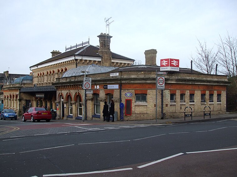
Photo: Sunil060902, CC BY-SA 3.0.
Denmark Hill is an interchange station between the Windrush line of the London Overground and National Rail services on the Catford loop line, located in Denmark Hill in South London. Denmark Hill railway station is situated 1,700 feet southeast of Rock Steady Eddie’s.
King’s College Hospital
Hospital

Photo: Secretlondon, CC BY-SA 3.0.
King's College Hospital is a major teaching hospital and major trauma centre in Denmark Hill, Camberwell in the London Borough of Lambeth, referred to locally and by staff simply as "King's" or abbreviated internally to "KCH". King’s College Hospital is situated 1,300 feet south of Rock Steady Eddie’s.
King’s College London GKT School of Medical Education
University
King's College London GKT School of Medical Education is the medical school of King's College London. The school has campuses at three institutions, Guy's Hospital, King's College Hospital and St Thomas' Hospital in London – with the initial of each hospital making up the acronymous name of the school. King’s College London GKT School of Medical Education is situated 1,200 feet south of Rock Steady Eddie’s.
Places in the Area
Nearby places include Camberwell and Denmark Hill.
Camberwell
Suburb

Photo: Secretlondon, CC BY-SA 3.0.
Camberwell is an area of South London, England, in the London Borough of Southwark, 2+3⁄4 miles southeast of Charing Cross. Camberwell was first a village associated with the church of St Giles and a common of which Goose Green is a remnant.
Denmark Hill
Quarter

Photo: Jwslubbock, CC BY-SA 3.0.
Denmark Hill is an area and road in Camberwell, in the London Borough of Southwark, London, England. It is a sub-section of the western flank of the Norwood Ridge, centred on the long, curved Ruskin Park slope of the ridge.
Loughborough Junction
Suburb

Photo: Jwslubbock, CC BY-SA 3.0.
Loughborough Junction is an area in Herne Hill, South London, in the London Borough of Lambeth. It is located equidistant between Herne Hill, Brixton and Camberwell providing excellent transport connections to Central London.
Rock Steady Eddie’s
Latitude
51.47206° or 51° 28′ 19″ northLongitude
-0.09339° or 0° 5′ 36″ westOpen location code
9C3XFWC4+RJOpenStreetMap ID
node 12572476223OpenStreetMap feature
amenity=cafe
This page is based on OpenStreetMap, Wikidata, and Wikimedia Commons.
We’d love your help improving our open data sources. Thank you for contributing.
Satellite Map
Discover Rock Steady Eddie’s from above in high-definition satellite imagery.
Notable Places Nearby
Highlights include Camberwell Green Post Office and Possibility Assembly Church.
Nearby Places
Explore places such as Paddy Power and Latin House.
England: Must-Visit Destinations
Delve into London, Manchester, Sheffield, and Leeds.
Curious Cafés to Discover
Uncover intriguing cafés from every corner of the globe.
About Mapcarta. Data © OpenStreetMap contributors and available under the Open Database License". Text is available under the CC BY-SA 4.0 license, except for photos, directions, and the map. Photo: Loz Pycock, CC BY-SA 2.0.