Feuerwehr Marbach
Feuerwehr Marbach is a fire station in Leubsdorf, Mittelsachsen, Saxony which is located on Schulgasse. Feuerwehr Marbach is situated nearby to the peak Gerichtsberg, as well as near Butterberg.| Tap on a place to explore it |
- Email: feuerwehr.marbach@gmail.com
- Type: Fire station
- Address: Schulgasse 3, Marbach, Leubsdorf, 09573
Places of Interest Nearby
Highlights include Kgl.-sächs. Postmeilenstein Leubsdorf and Station 90 Waldkirchen.
Kgl.-sächs. Postmeilenstein Leubsdorf
Historic site

Photo: Wikimedia, CC BY-SA 3.0.
Kgl.-sächs. Postmeilenstein Leubsdorf is a historic site, which is situated 1½ km west of Feuerwehr Marbach.
Station 90 Waldkirchen
Historic site
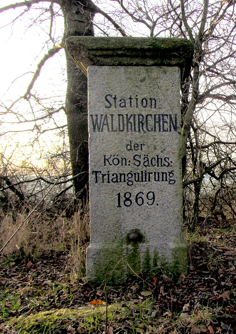
Photo: Wikimedia, CC BY-SA 3.0.
Station 90 Waldkirchen is a historic site, which is situated 2 km southwest of Feuerwehr Marbach.
Grünhainichen-Borstendorf railway station
Railway station

Photo: Aagnverglaser, CC BY-SA 4.0.
Grünhainichen-Borstendorf railway station is situated 2½ km southeast of Feuerwehr Marbach.
Places in the Area
Nearby places include Grünhainichen and Waldkirchen.
Grünhainichen
Village

Photo: Miebner, CC BY-SA 3.0.
Grünhainichen is a municipality in the district Erzgebirgskreis, in Saxony, Germany. On 1 March 2009, Grünhainichen and the neighboring municipality Waldkirchen were merged. On 1 January 2015, the former municipality Borstendorf became part of Grünhainichen. Grünhainichen is situated 2½ km southeast of Feuerwehr Marbach.
Waldkirchen
Village
Waldkirchen is a village and former municipality in the district of Erzgebirgskreis, in Saxony, Germany. Since 1 March 2009 it has been part of the municipality of Grünhainichen. Waldkirchen is situated 2½ km southwest of Feuerwehr Marbach.
Borstendorf
Village

Photo: Rauenstein, CC BY-SA 3.0.
Borstendorf is a village and a former municipality in the district Erzgebirgskreis, in Saxony, Germany. Since 1 January 2015 it is part of the municipality Grünhainichen. Borstendorf is situated 3½ km southeast of Feuerwehr Marbach.
Feuerwehr Marbach
- Location: Leubsdorf, Mittelsachsen, Saxony, Germany, Central Europe, Europe
- View on OpenStreetMap
Latitude
50.78823° or 50° 47′ 18″ northLongitude
13.13314° or 13° 7′ 59″ eastOpen location code
9F2MQ4QM+77OpenStreetMap ID
node 12586001011OpenStreetMap feature
amenity=fire_station
This page is based on OpenStreetMap, Wikidata, and Wikimedia Commons.
We’d love your help improving our open data sources. Thank you for contributing.
Satellite Map
Discover Feuerwehr Marbach from above in high-definition satellite imagery.
Places with the Same Name
Discover other places named “Feuerwehr Marbach”.
Notable Places Nearby
Highlights include Gerichtsberg and Butterberg.
Nearby Places
Explore places such as Tinow´s Show and Marbach, Lindenplatz.
Saxony: Must-Visit Destinations
Delve into Dresden, Leipzig, Chemnitz, and Meißen.
Curious Fire Stations to Discover
Uncover intriguing fire stations from every corner of the globe.
About Mapcarta. Data © OpenStreetMap contributors and available under the Open Database License". Text is available under the CC BY-SA 4.0 license, except for photos, directions, and the map. Photo: Taxiarchos228, FAL.