Podmakar’evo
Podmakar’evo is a locality in Ryazan Oblast, Central Russia. Podmakar’evo is situated nearby to the village Poplevinskiy, as well as near the locality Ol’shanka.| Tap on a place to explore it |
Places in the Area
Nearby places include Pobedinka and Tsentral’nyy.
Pobedinka
Village
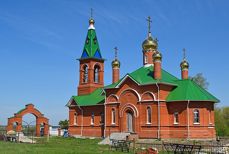
Photo: Seryogin100, CC BY-SA 4.0.
Pobedinka is an urban locality in Skopinsky District of Ryazan Oblast, Russia. Population: 1,456 ;… Pobedinka is situated 3½ km northeast of Podmakar’evo.
Tsentral’nyy
Village

Photo: Bok, CC BY-SA 4.0.
Tsentralny is an urban locality in Miloslavsky District of Ryazan Oblast, Russia. Population: 2,159 ; 1,960 ; 2,588 . Tsentral’nyy is situated 7 km east of Podmakar’evo.
Podmakar’evo
- Type: Locality
- Postal code: 391793
- Location: Ryazan Oblast, Central Russia, Russia, Eastern Europe, Europe
- View on OpenStreetMap
Latitude
53.68936° or 53° 41′ 22″ northLongitude
39.52858° or 39° 31′ 43″ eastOpen location code
9G5XMGQH+PCOpenStreetMap ID
node 1259119977OpenStreetMap feature
place=locality
This page is based on OpenStreetMap, Wikidata, and Wikimedia Commons.
We’d love your help improving our open data sources. Thank you for contributing.
Satellite Map
Discover Podmakar’evo from above in high-definition satellite imagery.
In Other Languages
“Podmakar’evo” goes by many names.
- Russian: “Подмакарьево”
Localities in the Area
Explore places such as Podmakar’evo and Poplevinskiy.
Notable Places Nearby
Highlights include шахта № 53 and Террикон закрытой шахты № 50.
Central Russia: Must-Visit Destinations
Delve into Moscow, Outskirts, Podolsk, and Smolensk.
Curious Localities to Discover
Uncover intriguing localities from every corner of the globe.
About Mapcarta. Data © OpenStreetMap contributors and available under the Open Database License". Text is available under the CC BY-SA 4.0 license, except for photos, directions, and the map. Photo: A.Savin, CC BY-SA 3.0.