Draveljska cerkev
Draveljska cerkev is a parking area in Dravlje District, Ljubljana. Draveljska cerkev is situated nearby to Trg Janeza Pavla II., as well as near Church of the Incarnation of Christ.| Tap on a place to explore it |
Places of Interest Nearby
Highlights include Saint Roch Plague Column and Ljubljana Stegne.
Saint Roch Plague Column
Wayside shrine

Photo: Miha Peče, CC BY-SA 4.0.
Saint Roch Plague Column is a wayside shrine, which is situated 380 metres east of Draveljska cerkev.
Ljubljana Stegne
Railway stop
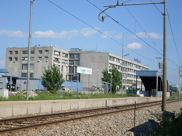
Photo: Ajznponar, CC BY-SA 3.0.
Ljubljana Stegne is a railway stop, which is situated 730 metres northeast of Draveljska cerkev.
Osnovna šola Valentina Vodnika
School

Photo: Anjajug, CC BY-SA 4.0.
Osnovna šola Valentina Vodnika is a school, which is situated 1 km south of Draveljska cerkev.
Places in the Area
Nearby places include Zapuže and Pržan.
Zapuže
Neighborhood

Photo: Doremo, CC BY-SA 4.0.
Zapuže is a former settlement in central Slovenia in the northwest part of the capital Ljubljana. It belongs to the Dravlje District of the City Municipality of Ljubljana.
Pržan
Neighborhood
Pržan is a former settlement in central Slovenia in the northwest part of the capital Ljubljana. It belongs to the Šentvid District of the City Municipality of Ljubljana.
Zgornja Šiška
Neighborhood

Photo: Mich973, CC BY-SA 3.0.
Zgornja Šiška is a formerly independent settlement in the northwest part of the capital Ljubljana in central Slovenia. It is part of the traditional region of Upper Carniola and is now included with the rest of the municipality in the Central Slovenia Statistical Region.
Draveljska cerkev
- Type: Parking area
- Parking: surface
- Category: transportation
- Location: Dravlje District, Ljubljana, Slovenia, Central Europe, Europe
- View on OpenStreetMap
Latitude
46.08247° or 46° 4′ 57″ northLongitude
14.47286° or 14° 28′ 22″ eastOpen location code
8FRP3FJF+X4OpenStreetMap ID
node 1259782977OpenStreetMap feature
amenity=parkingOpenStreetMap attribute
parking=surface
This page is based on OpenStreetMap, Wikidata, and Wikimedia Commons.
We’d love your help improving our open data sources. Thank you for contributing.
Satellite Map
Discover Draveljska cerkev from above in high-definition satellite imagery.
Notable Places Nearby
Highlights include Trg Janeza Pavla II. and Draveljska cerkev sv. Roka.
Nearby Places
Explore places such as Terasa Bar and AE Kogovšek.
Slovenia: Must-Visit Destinations
Delve into Ljubljana, Maribor, Koper, and Celje.
Curious Parking Areas to Discover
Uncover intriguing parking areas from every corner of the globe.
About Mapcarta. Data © OpenStreetMap contributors and available under the Open Database License". Text is available under the CC BY-SA 4.0 license, except for photos, directions, and the map. Photo: Jjtkk, CC BY 3.0.