Oftv0172 Jaime Nuno
Oftv0172 Jaime Nuno is a school in Mexico State, Central Mexico which is located on Calle Cerros De Guanajuato. Oftv0172 Jaime Nuno is situated nearby to the amusement arcade Videojuegos, as well as near the bus station Ruta 31.| Tap on a place to explore it |
Places of Interest Nearby
Highlights include Estadio José Ortega Martínez.
Estadio José Ortega Martínez
Stadium
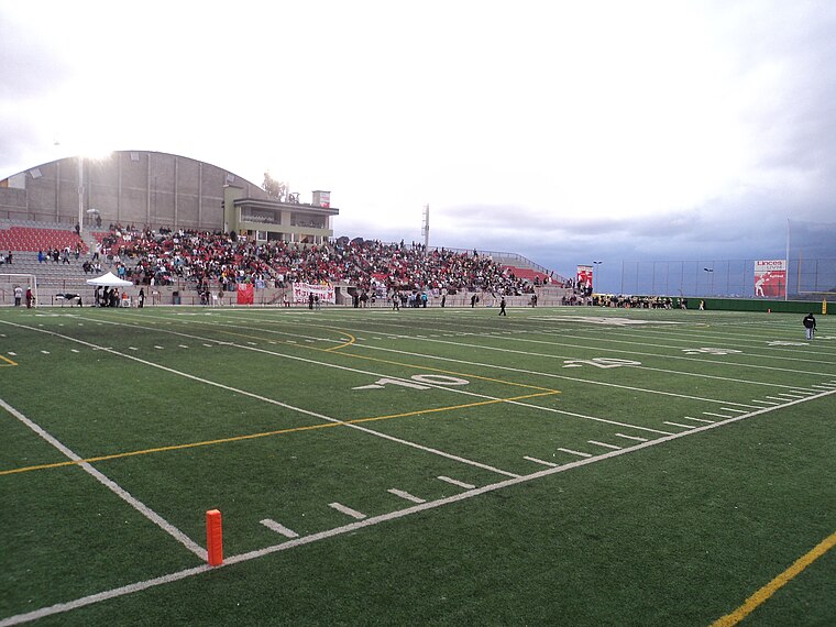
Photo: Evil Knight, CC BY-SA 3.0.
The Estadio José Ortega Martínez also known as Valley Bowl Stadium, is a stadium of football with capacity for 3,700 people located in Naucalpan, State of Mexico, campus Lomas Verdes Universidad del Valle de Mexico. Estadio José Ortega Martínez is situated 2 km northeast of Oftv0172 Jaime Nuno.
Places in the Area
Nearby places include Ciudad Satelite and Nuevo Polanco.
Ciudad Satelite
 Ciudad Satelite, or simply "Satelite", is part of the metropolitan area of Mexico City. Although there is a specific borough bearing that name, locals refer to Satelite to a broader area including other boroughs or colonias that are located right after crossing the city limits of the Distrito Federal into the State of Mexico.
Nuevo Polanco
Quarter

Photo: Wikimedia, CC BY-SA 3.0.
Nuevo Polanco is an area of Mexico City formerly consisting of warehouses and factories, bordering the upscale Polanco on the north across Avenida Ejército Nacional. Nuevo Polanco is situated 10 km southeast of Oftv0172 Jaime Nuno.
Oftv0172 Jaime Nuno
- Type: School
- Address: Calle Cerros De Guanajuato, 53218
- Category: education
- Location: Mexico State, Central Mexico, Mexico, North America
- View on OpenStreetMap
Latitude
19.49231° or 19° 29′ 32″ northLongitude
-99.27793° or 99° 16′ 41″ westOpen location code
76F2FPRC+WROpenStreetMap ID
node 12616493794OpenStreetMap feature
amenity=school
This page is based on OpenStreetMap, Wikidata, and Wikimedia Commons.
We’d love your help improving our open data sources. Thank you for contributing.
Satellite Map
Discover Oftv0172 Jaime Nuno from above in high-definition satellite imagery.
Notable Places Nearby
Highlights include Videojuegos and Ruta 31.
Nearby Places
Explore places such as Escuela Primaria Ricardo Flores Magon and Escuela Primaria Emiliano Zapata.
Mexico State: Must-Visit Destinations
Delve into Tequixquiac, Toluca, Teotihuacan, and Ecatepec.
Curious Schools to Discover
Uncover intriguing schools from every corner of the globe.
About Mapcarta. Data © OpenStreetMap contributors and available under the Open Database License". Text is available under the CC BY-SA 4.0 license, except for photos, directions, and the map. Photo: Wikimedia, CC0.