The Wooden Dolly
The Wooden Dolly is in North Tyneside, England. The Wooden Dolly is situated nearby to the food court The Loading Bay, as well as near the government office North Tyneside Register Office.| Tap on a place to explore it |
Places of Interest Nearby
Highlights include Arbeia and Fish Quay Old High Light.
Arbeia
Archaeological site

Photo: Thryduulf, CC BY-SA 4.0.
Arbeia was a large Roman fort in South Shields, Tyne & Wear, England, now ruined, and which has been partially reconstructed. It was first excavated in the 1870s. Arbeia is situated 2,400 feet southeast of The Wooden Dolly.
Fish Quay Old High Light
Lighthouse

Photo: Ken Brown, CC BY-SA 2.0.
The High and Low Lights of North Shields are decommissioned leading lights in North Shields, Tyne and Wear in the United Kingdom. Two pairs of lights survive: the older pair date from 1727 and were operational until 1810; the newer pair then took over, remaining in use until 1999. Fish Quay Old High Light is situated 1,200 feet northeast of The Wooden Dolly.
North Shields
Railway station
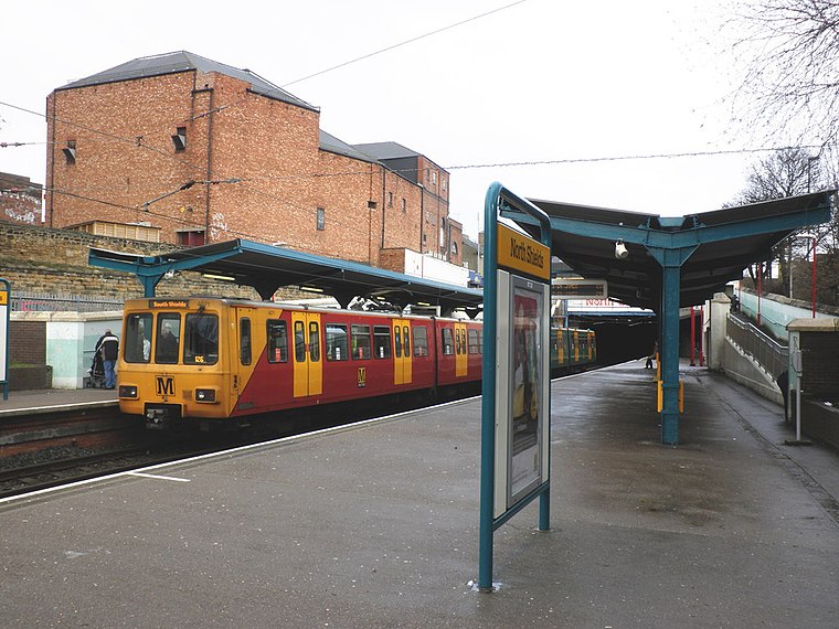
Photo: Roger Cornfoot, CC BY-SA 2.0.
North Shields is a Tyne and Wear Metro station, serving the coastal town of North Shields. It is situated next to the North Shields Transport Hub, on the west side of Bedford Street and The Beacon Centre. North Shields is situated 1,600 feet west of The Wooden Dolly.
Places in the Area
Nearby places include North Shields and South Shields.
North Shields
Town

Photo: Bill Henderson, CC BY-SA 2.0.
North Shields is a town in the borough of North Tyneside in Tyne and Wear, England. It is 8 miles north-east of Newcastle upon Tyne and borders nearby Wallsend and Tynemouth.
South Shields
Town

Photo: AlasdairW, CC BY-SA 3.0.
South Shields is a coastal port town in South Tyneside, Tyne and Wear, England; it lies on the south bank of the mouth of the River Tyne. The town was known in Roman times as Arbeia and as Caer Urfa by the Early Middle Ages.
Tynemouth

Photo: AlasdairW, CC BY-SA 3.0.
Tynemouth is a large town in Tyne and Wear in northeast England, nine miles east of Newcastle upon Tyne. It's the largest of a series of towns on the north bank of the Tyne estuary, running into North Shields to the west and Cullercoats to the north, also described on this page.
The Wooden Dolly
- Type: Sign
- Categories: information and tourism
- Location: North Tyneside, England, United Kingdom, Britain and Ireland, Europe
- View on OpenStreetMap
Latitude
55.00716° or 55° 0′ 26″ northLongitude
-1.44139° or 1° 26′ 29″ westOpen location code
9C7W2H45+VCOpenStreetMap ID
node 12616749109OpenStreetMap feature
tourism=information
This page is based on OpenStreetMap, Wikidata, and Wikimedia Commons.
We’d love your help improving our open data sources. Thank you for contributing.
Satellite Map
Discover The Wooden Dolly from above in high-definition satellite imagery.
Notable Places Nearby
Highlights include North Tyneside Register Office and The Loading Bay.
Nearby Places
Explore places such as Prince of Wales Tavern and Liddell Street (W/B).
England: Must-Visit Destinations
Delve into London, Manchester, Sheffield, and Leeds.
Curious Places to Discover
Uncover intriguing places from every corner of the globe.
About Mapcarta. Data © OpenStreetMap contributors and available under the Open Database License". Text is available under the CC BY-SA 4.0 license, except for photos, directions, and the map. Photo: sidibousaid, CC BY 2.0.