Urbanització Lo Xotxim
Urbanització Lo Xotxim is a neighborhood in Elche, Costa Blanca, Valencian Community. Urbanització Lo Xotxim is situated nearby to the locality Finca Lo Xotxim, as well as near the neighborhood Urbanització L’Ermita Vella.| Tap on a place to explore it |
Places in the Area
Nearby places include Santa Pola and L’Altet.
Santa Pola
 Santa Pola is in the province of Alicante, around 20 km south of the city. The main attractions of Santa Pola are its historical remains, its port, its salt flats and its beaches with the blue flag, a symbol of environmental quality awarded by the European Foundation for Environmental Education.
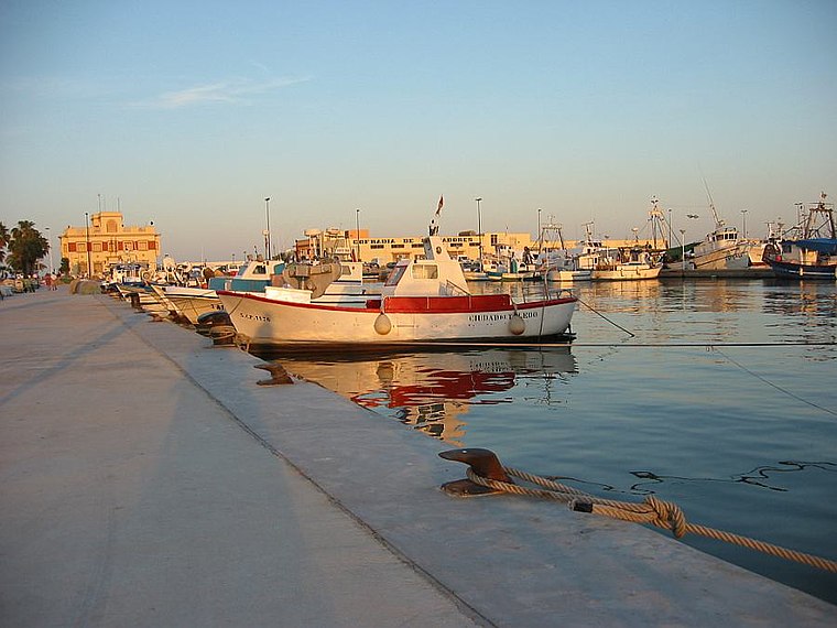
L’Altet
Village

Photo: PLV2, CC BY-SA 4.0.
L’Altet is a village, which is situated 5 km northeast of Urbanització Lo Xotxim.
Arenales del Sol
Suburb
 Arenales del Sol is a suburb, which is situated 6 km east of Urbanització Lo Xotxim.
Urbanització Lo Xotxim
- Type: Neighborhood
- Category: locality
- Location: Elche, Costa Blanca, Alicante, Valencian Community, Eastern Spain, Spain, Iberia, Europe
- View on OpenStreetMap
Latitude
38.23556° or 38° 14′ 8″ northLongitude
-0.57941° or 0° 34′ 46″ westOpen location code
8CCX6CPC+66OpenStreetMap ID
node 12682401595OpenStreetMap feature
place=neighbourhood
This page is based on OpenStreetMap, Wikidata, and Wikimedia Commons.
We’d love your help improving our open data sources. Thank you for contributing.
Satellite Map
Discover Urbanització Lo Xotxim from above in high-definition satellite imagery.
In Other Languages
“Urbanització Lo Xotxim” goes by many names.
- Catalan: “Urbanització Lo Xotxim”
Localities in the Area
Explore places such as Finca Lo Xotxim and Urbanització L’Ermita Vella.
Notable Places Nearby
Highlights include Centre Sociocultural Vallverde and Ermita de Santa Anna de Vallverda.
Costa Blanca: Must-Visit Destinations
Delve into Alicante, Benidorm, Torrevieja, and Dénia.
Curious Neighborhoods to Discover
Uncover intriguing neighborhoods from every corner of the globe.
About Mapcarta. Data © OpenStreetMap contributors and available under the Open Database License". Text is available under the CC BY-SA 4.0 license, except for photos, directions, and the map. Photo: Wikimedia, CC0.