Limers Lane
Limers Lane is a bus stop in Northam, Torridge District, England. Limers Lane is situated nearby to Durrant Hotel, as well as near St Mary’s Church of England Primary School.| Tap on a place to explore it |
Places of Interest Nearby
Highlights include Burton at Bideford and Torridge Bridge.
Burton at Bideford
Museum
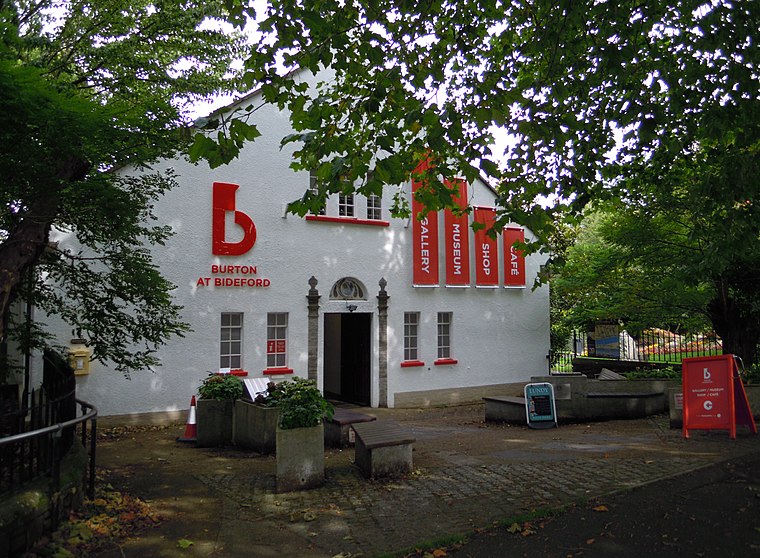 The Burton at Bideford is an art gallery and museum on Kingsley Road in Victoria Park, in Bideford, Devon, England. It houses collections on various topics connected with Bideford’s history and cultural heritage. Burton at Bideford is situated 4,100 feet southeast of Limers Lane.
Torridge Bridge
Bridge

Photo: Philip Halling, CC BY-SA 2.0.
The Torridge Bridge is a 650-metre-long concrete bridge, situated broadly in an east-west direction, built in 1987 in Bideford, England over the River Torridge. Torridge Bridge is situated 2,800 feet east of Limers Lane.
Victoria Park
Park

Photo: Lewis Clarke, CC BY-SA 2.0.
Victoria Park is an urban park in Bideford, Devon, England. The park opened in 1912 to celebrate the reign of Queen Victoria, the gates erected for the opening are listed with Historic England. Victoria Park is situated 3,800 feet southeast of Limers Lane.
Places in the Area
Nearby places include Bideford and Westward Ho!.
Bideford

Photo: RobThinks, CC BY-SA 4.0.
Bideford is a town in North Devon on the River Torridge. For visitors, the main features of Bideford are its quaint back streets full of shops, its pannier market, and many festivals & events throughout the year such as the Bideford Bike Show, Soapbox Derby, Rowing Regatta, Water Festival & Rainbo Fun Run.
Westward Ho!
 Westward Ho! is a quaintly-named seaside town in Torridge, Devon, England, near Bideford! Beware however, that's where the quaintness ends. Westward Ho! is in some need of investment, although it retains a good variety of quality local businesses, and its beach is highly regarded and noted for the cleanliness of its water.
Appledore
Village
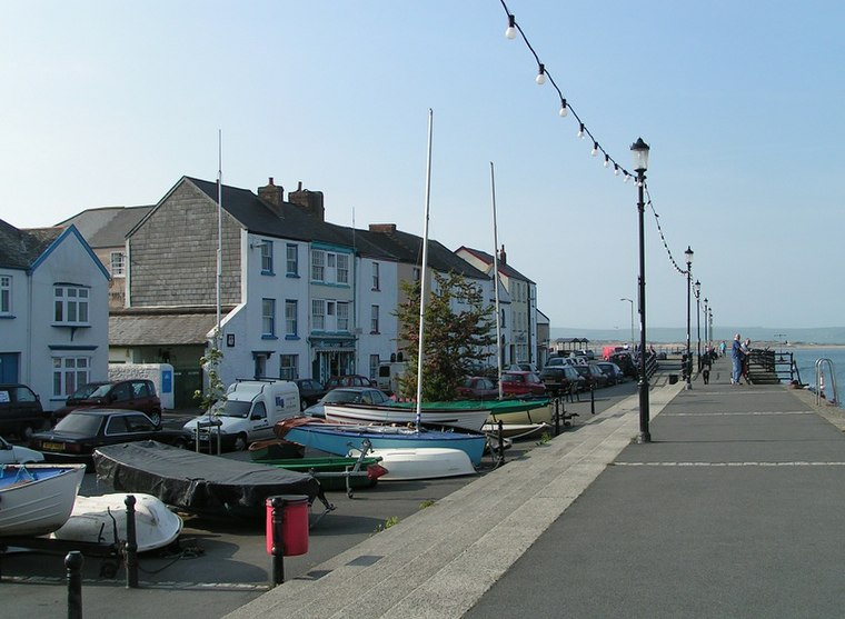
Photo: Sannse, CC BY-SA 3.0.
Appledore is a village at the mouth of the River Torridge, about 6 miles west of Barnstaple and about 3 miles north of Bideford in the county Devon, England. Appledore is situated 2 miles northeast of Limers Lane.
Limers Lane
- Type: Bus stop
- Category: transportation
- Location: Northam, Torridge District, Devon, West Country, England, United Kingdom, Britain and Ireland, Europe
- View on OpenStreetMap
Latitude
51.03149° or 51° 1′ 53″ northLongitude
-4.21254° or 4° 12′ 45″ westOpen location code
9C3Q2QJP+HXOpenStreetMap ID
node 12692118327OpenStreetMap feature
highway=bus_stopOpenStreetMap feature
public_transport=platform
This page is based on OpenStreetMap, Wikidata, and Wikimedia Commons.
We’d love your help improving our open data sources. Thank you for contributing.
Satellite Map
Discover Limers Lane from above in high-definition satellite imagery.
Notable Places Nearby
Highlights include Durrant Hotel and St Mary’s Church of England Primary School.
Nearby Places
Explore places such as Limers Lane and The Northam Care Trust.
Devon: Must-Visit Destinations
Delve into Plymouth, Exeter, Torquay, and Barnstaple.
Curious Bus Stops to Discover
Uncover intriguing bus stops from every corner of the globe.
About Mapcarta. Data © OpenStreetMap contributors and available under the Open Database License". Text is available under the CC BY-SA 4.0 license, except for photos, directions, and the map. Photo: matthewhartley369, CC BY-SA 2.0.