Robertson IP
Robertson IP is an office in Stow Hill, Newport, Wales which is located on Gold Tops. Robertson IP is situated nearby to St Mark’s Church, as well as near the government office Valuation Tribunal for Wales.| Tap on a place to explore it |
Places of Interest Nearby
Highlights include Newport Railway Station and St Mark’s Church.
Newport Railway Station
Railway station
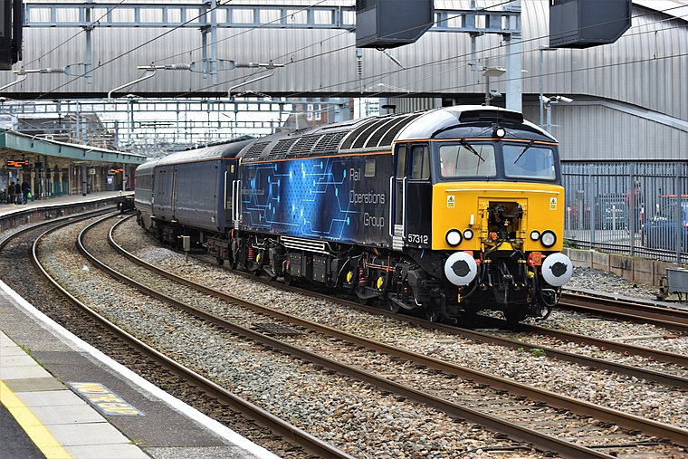
Photo: Wikimedia, CC BY-SA 2.0.
Newport is the second-busiest railway station in Wales. It is situated in Newport city centre and is 133 miles 13 chains from London Paddington measured via Bristol Parkway, and 158 miles 50 chains via Stroud. Newport Railway Station is situated 900 feet southeast of Robertson IP.
St Mark’s Church
Church

Photo: NickGeorge1993, CC BY-SA 3.0.
St Mark's Church, Gold Tops, is a Church in Wales church located in the Allt-yr-yn area of Newport, Wales. It is a Newport landmark and is part of the Newport North West Ministry Area.
Newport Crown Court
Courthouse

Photo: John Grayson, CC BY-SA 2.0.
Newport Crown Court is a Crown Court venue which deals with criminal cases at Faulkner Road in Newport in South Wales. Newport Crown Court is situated 580 feet south of Robertson IP.
Places in the Area
Nearby places include Baneswell and Barrack Hill.
Baneswell
Suburb
Baneswell is an inner-city district in the city of Newport, South Wales. It is in the electoral ward of Stow Hill, and located next to the city centre and Newport railway station.
Barrack Hill
Suburb
Barrack Hill is an area in Newport, Wales, located in the suburb, electoral ward and coterminous community parish of Allt-yr-yn. It is most well known for the Raglan Barracks, which stands on the top of the hill.
Crindau
Suburb
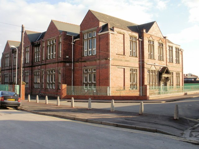
Photo: John Grayson, CC BY-SA 2.0.
Crindau is a Victorian inner-city area just north of the city centre in Newport in south-east Wales. It lies within the Shaftesbury electoral district and community.
Robertson IP
- Type: Office
- Address: 17 Gold Tops, Newport, NP20 4PH
- Location: Stow Hill, Newport, Wales, United Kingdom, Britain and Ireland, Europe
- View on OpenStreetMap
Latitude
51.58985° or 51° 35′ 24″ northLongitude
-3.00398° or 3° 0′ 14″ westOpen location code
9C3RHXQW+WCOpenStreetMap ID
node 12797591858OpenStreetMap feature
office=lawyer:speciality:intellectual_property
This page is based on OpenStreetMap, Wikidata, and Wikimedia Commons.
We’d love your help improving our open data sources. Thank you for contributing.
Satellite Map
Discover Robertson IP from above in high-definition satellite imagery.
Notable Places Nearby
Highlights include St Mark’s Church and Valuation Tribunal for Wales.
Nearby Places
Explore places such as Watkins & Gunn Solicitors and Wellfield Clinic.
Wales: Must-Visit Destinations
Delve into Cardiff, Swansea, Llanfairpwllgwyngyll, and Bangor.
Curious Offices to Discover
Uncover intriguing offices from every corner of the globe.
About Mapcarta. Data © OpenStreetMap contributors and available under the Open Database License". Text is available under the CC BY-SA 4.0 license, except for photos, directions, and the map. Photo: WelshDave, CC BY-SA 4.0.